Your Ultimate Guide to the Snaefellsnes Peninsula
Iceland in Miniature
Snæfellsnes is a place that feels like a world of its own. A narrow strip of land stretching into the Atlantic, it holds everything Iceland is known for—black sand beaches, lava fields, rugged cliffs, quiet fishing villages, and a glacier-covered volcano at its heart. Because of this, it’s often called “Iceland in Miniature.”
Driving through Snæfellsnes peninsula, you’ll see landscapes shift around every bend. One moment, you’re passing green fields where Icelandic horses graze. The next, you’re in a barren lava field, the ground jagged and black, shaped by eruptions long ago. The coastline is wild and restless, waves crashing against basalt cliffs. In between are small towns, each with a history tied to the sea.
Literature lovers might know the name Snæfellsjökull, the glacier that caps the peninsula’s volcano. Jules Verne imagined it as the gateway to the center of the earth in his novel Journey to the Center of the Earth. Some say the area has a strange energy. Others just see a place of quiet beauty. Either way, it leaves an impression.
A Top Day Trip from Reykjavík
Snæfellsnes is undoubtadely one of the best day trips from Reykjavík. It takes a full day—around 11 to 12 hours—but it’s worth it. Whether you rent a car or join a guided tour, the route is straightforward, and the scenery never disappoints.
It’s one of Iceland’s top five day trips, along with:
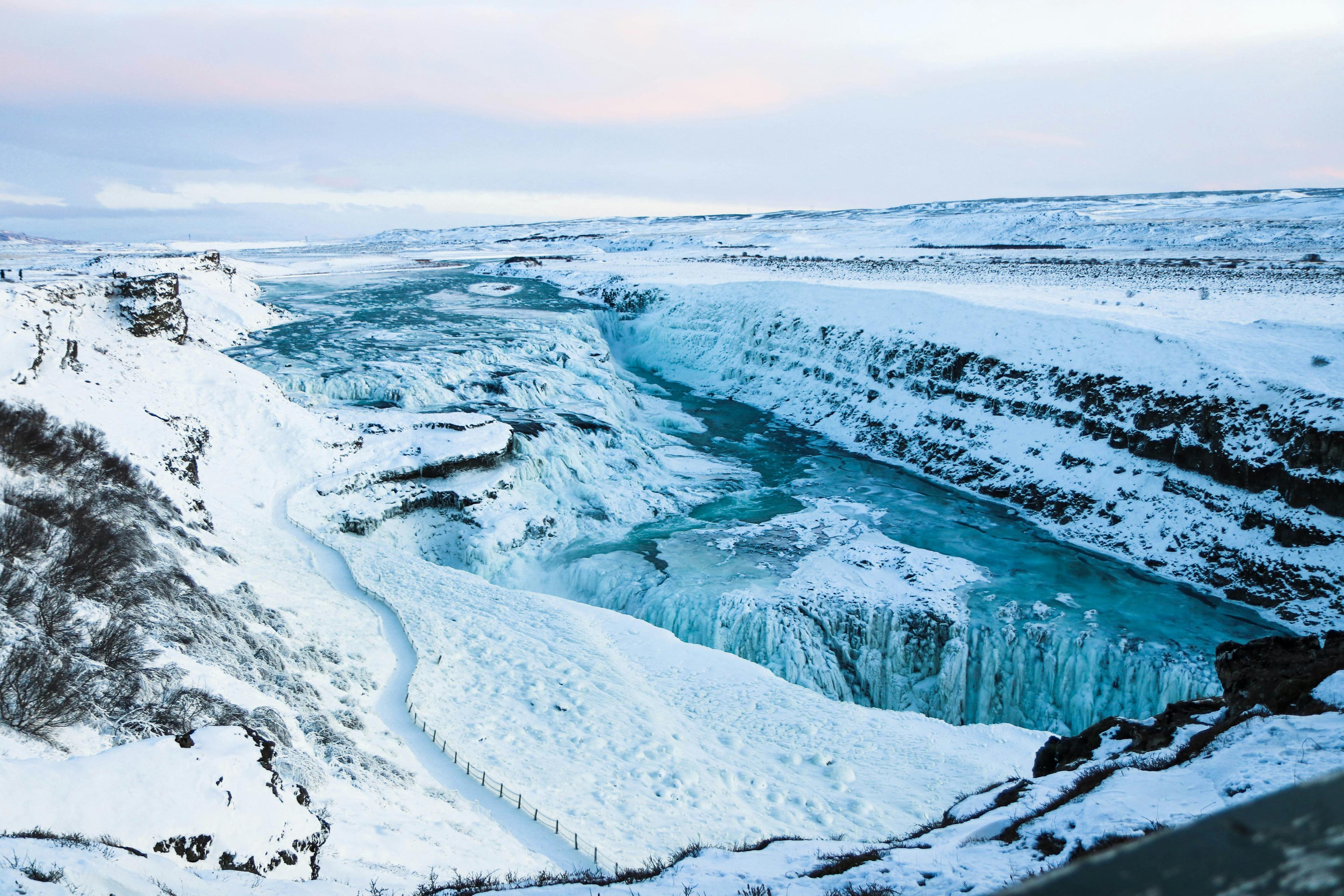
- Golden Circle – The country’s most famous route, featuring Geysir, Gullfoss waterfall, and Þingvellir National Park.
- Silver Circle – A less-traveled path with lava waterfalls, ice caves, and Húsafell.
- Reykjanes Peninsula – A volcanic wonderland home to hot springs, lava fields, and the Blue Lagoon.
- South Coast – A land of towering waterfalls, glaciers, and black sand beaches.
Snæfellsnes offers something different. It has the same raw beauty as the South Coast but with fewer crowds. It has geothermal energy like Reykjanes, but also mountains, cliffs, fishing villages, and a glacier. It’s a mix of everything—without feeling rushed or overrun.
For independent travelers, self-driving is a great option. The roads are paved and maintained all year round. For those who prefer a more relaxed experience, guided tours offer local insight and an easy way to enjoy the journey without worrying about the drive.
No matter how you go, Snæfellsnes in a day is possible. And once you’re on the road, you’ll see why it’s a trip worth taking.
Snæfellsnes is a mix of everything—raw beauty, glacier-topped volcanoes, postcard-perfect spots, dramatic cliffs, black sand beaches, and quaint fishing villages—without the crowds or the rush.
The Journey to Snæfellsnes
The road out of Reykjavík is familiar to anyone who has driven Iceland’s Ring Road. Heading north on Route 1, the city fades quickly, replaced by wide-open landscapes. Moss-covered lava fields give way to rolling farmland, where clusters of sheep and Icelandic horses graze.
The drive is quiet, smooth. After about an hour, the road crosses a long bridge over the fjord and arrives in Borgarnes—the last major town before entering Snæfellsnes. It’s a good place to stop, stretch your legs, and grab coffee or snacks. The town has history, too—an old trading post, home to stories from the Icelandic sagas.
From here, the journey turns west onto Route 54, and the landscape begins to change. The mountains grow sharper, more dramatic. The coastline draws closer. Soon, the road curves through old lava fields, hardened waves of black rock stretching toward the sea. The air feels different—colder, wilder.
This is where Snæfellsnes begins.
The Snæfellsnes round trip, with stops at the top highlights, is a full but rewarding day from Reykjavík—one of the best day trips in Iceland.
Highlights of Snæfellsnes
The road westward unfolds like a slow-moving film, each scene shifting into the next. The beauty of Snæfellsnes is in its variety—you’re never looking at the same kind of landscape for long. The stops along the way feel unhurried, each one distinct.
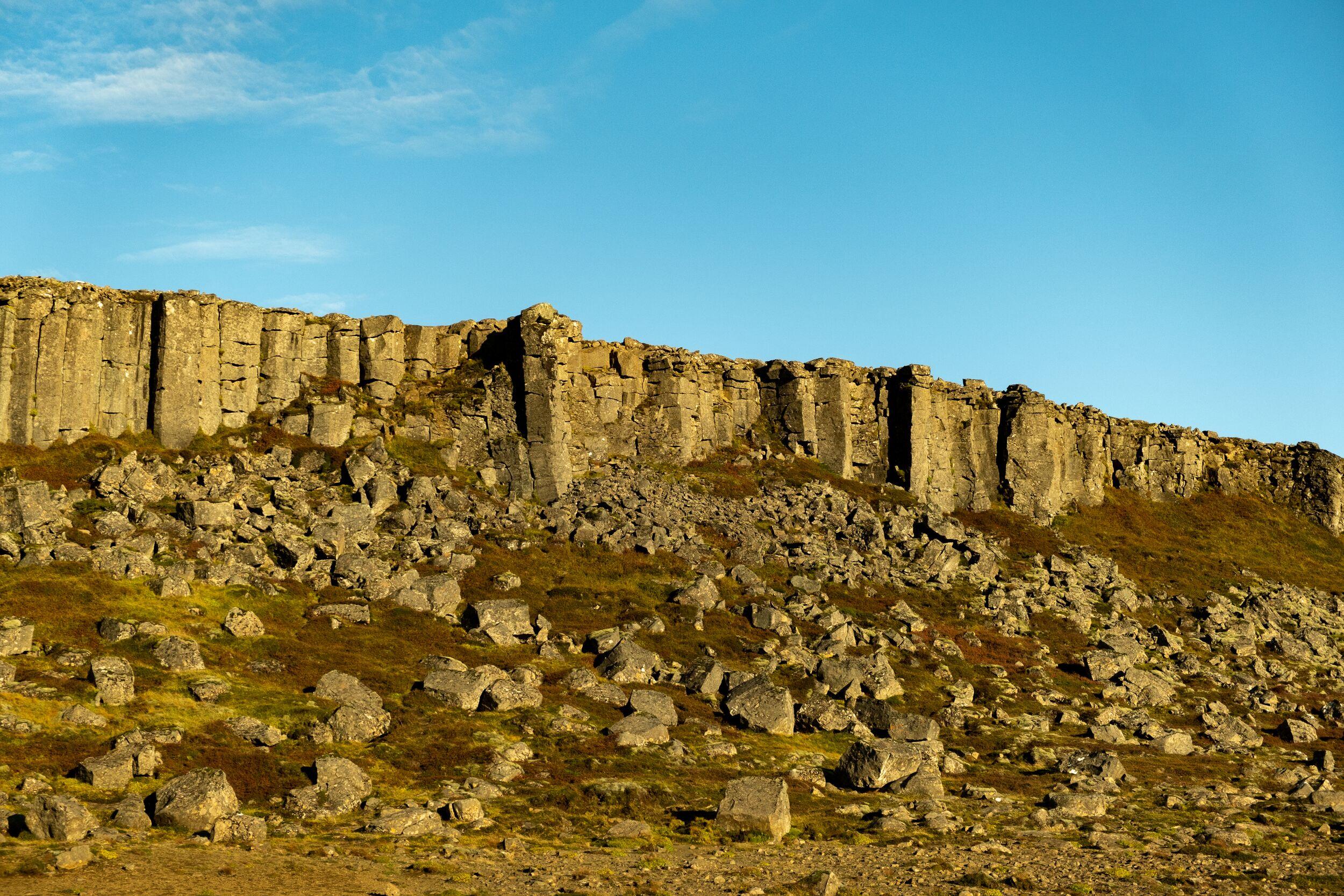
Gerðuberg Cliffs
The first highlight is Gerðuberg, a long, unexpected wall of basalt columns rising from the earth in near-perfect symmetry. They look almost man-made, but they are nature’s own work—formed by cooling lava. The cliffs stretch for hundreds of meters, standing tall like organ pipes. It’s a quick stop, but a striking one.
Ytri-Tunga Beach
Not far from Gerðuberg, Ytri-Tunga is a rare sight in Iceland: a golden-sand beach. Most beaches here are black, shaped by volcanic eruptions, but Ytri-Tunga is different. The real reason to stop, though, is the seals. They haul themselves onto the rocks just offshore, lounging in the cold wind, unbothered by visitors. Some bob in the water, their heads just above the surface, watching.
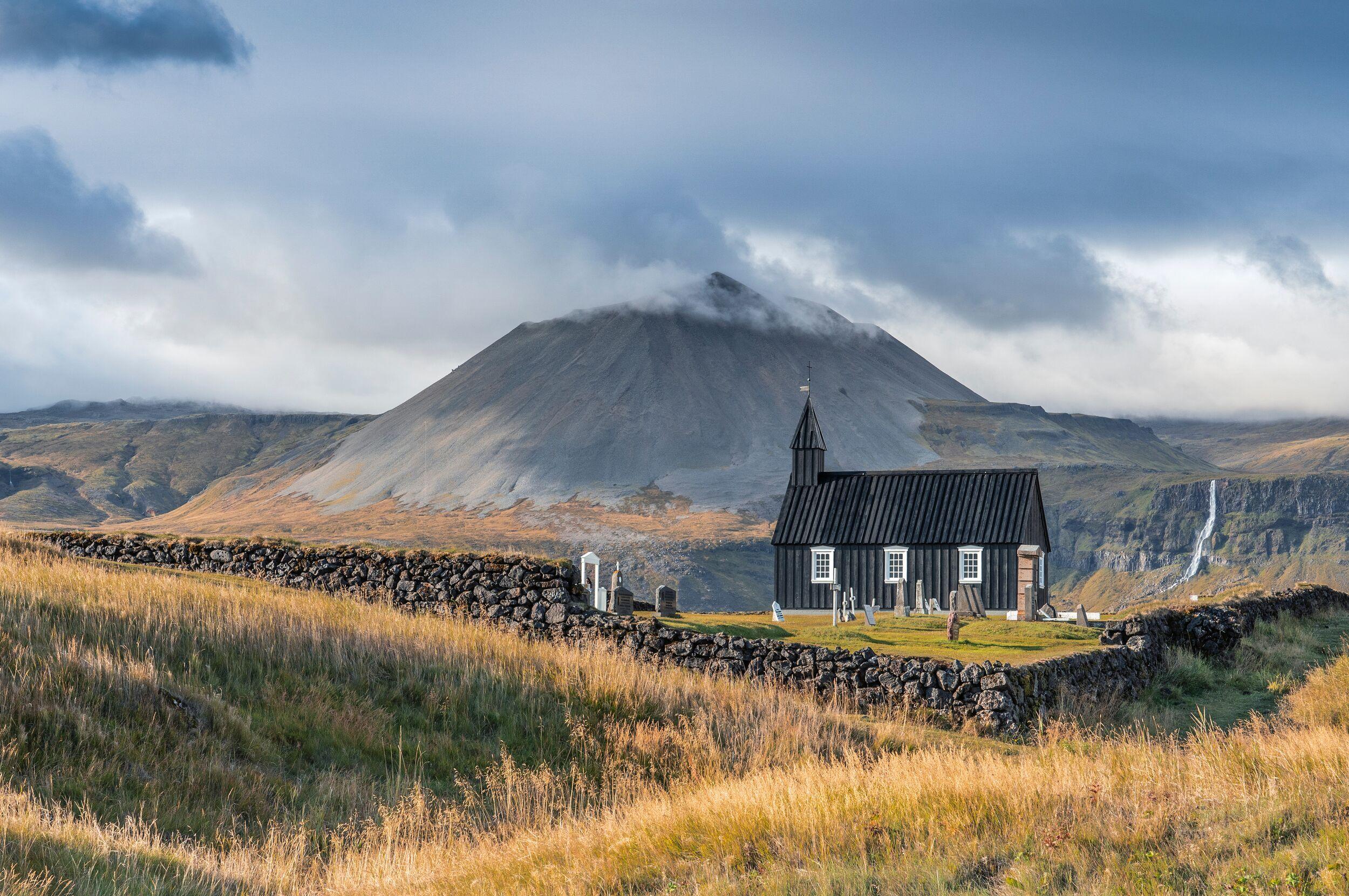
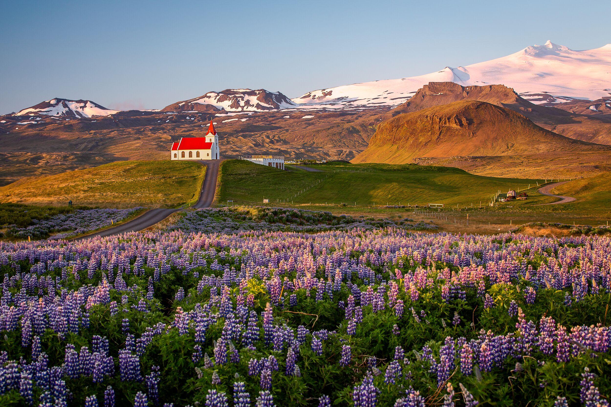
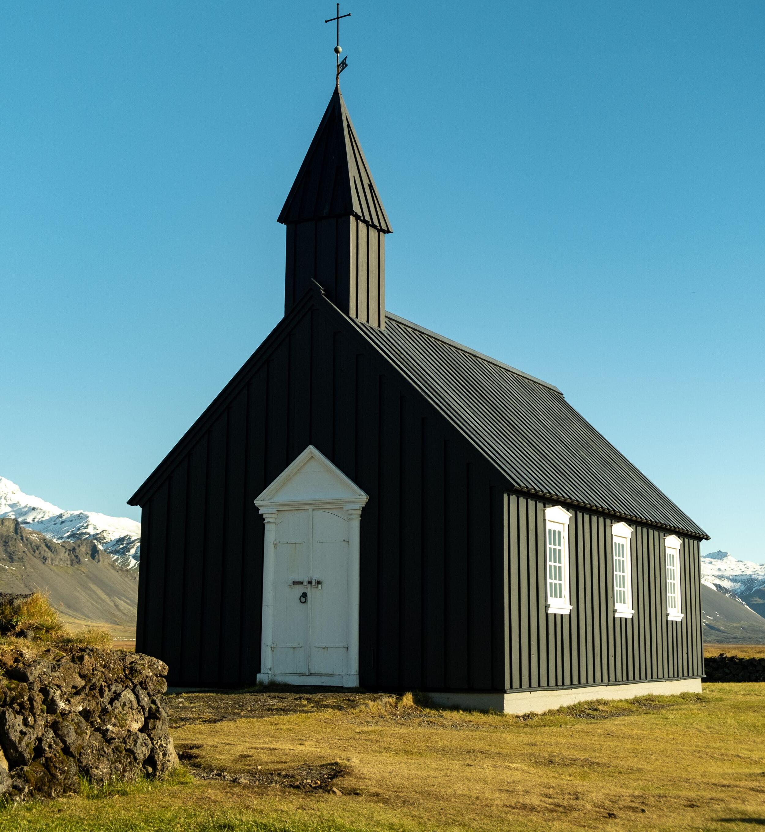
Búðir and the Black Church
A lone black church stands in the middle of nowhere. That’s what it feels like when you arrive at Búðir. The tiny wooden church, painted deep black, stands against a backdrop of green moss, white-tipped mountains, and open sky. It’s quiet here—just the wind and the crunch of gravel underfoot. A moment of stillness before moving on.
Lóndrangar – The Towers of the Coast
The Lóndrangar are two towering basalt pillars rising from the shoreline like the ruins of an ancient fortress. Formed by volcanic activity and carved by centuries of wind and sea, these natural rock formations are some of the most striking on the peninsula.
A short walk from the parking area leads to a viewpoint overlooking the cliffs, where seabirds nest in the craggy rock face, and the ocean churns below. In summer, puffins, fulmars, and kittiwakes fill the air, their calls blending with the sound of the waves.
Locals say the area is home to hidden people (huldufólk), Iceland’s legendary elves, and some fishermen once avoided the cliffs out of respect. Whether you believe in folklore or not, the place has an unmistakable presence—a sense of time stretching far beyond human history.
For those looking to explore further, a coastal walking path connects Lóndrangar with the nearby Þúfubjarg cliffs, offering even more dramatic views of Snæfellsnes' wild, volcanic coastline.
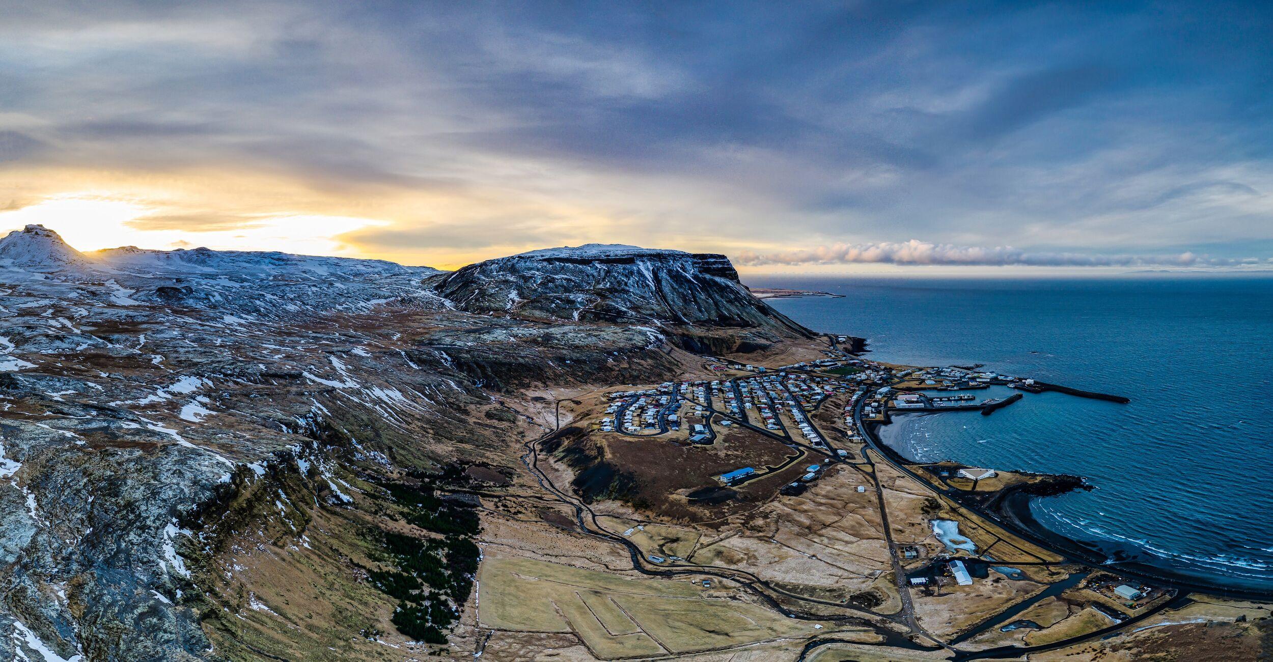
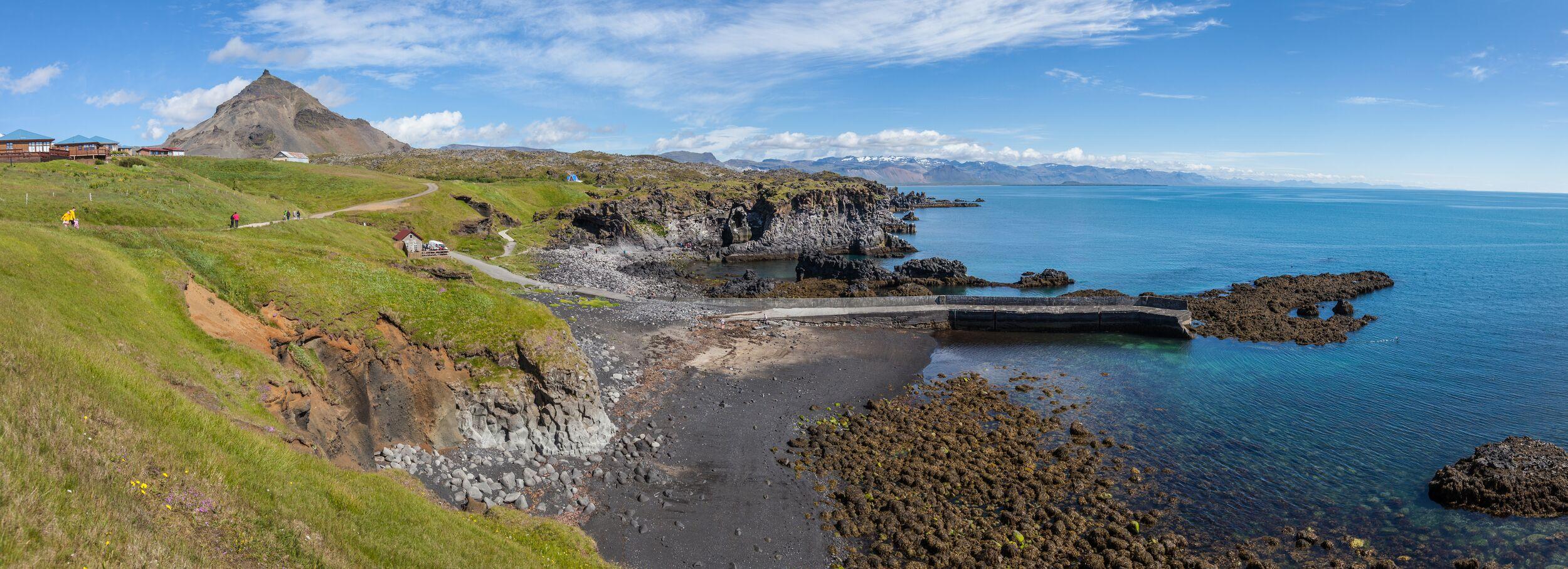
Arnarstapi and Hellnar
The road continues west, winding along the coast. Soon, it reaches Arnarstapi, a small fishing village that feels like it belongs in a storybook. A short walk from the parking lot leads to the cliffs—where waves crash against rock arches, and seabirds nest in the cracks.
The coastal walk to Hellnar is one of the best short walks in Iceland. Just a few kilometers, but filled with rugged beauty—jagged lava formations, pounding surf, and deep caves carved by the sea.
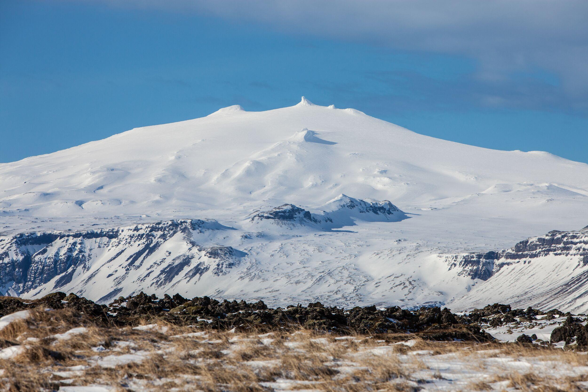
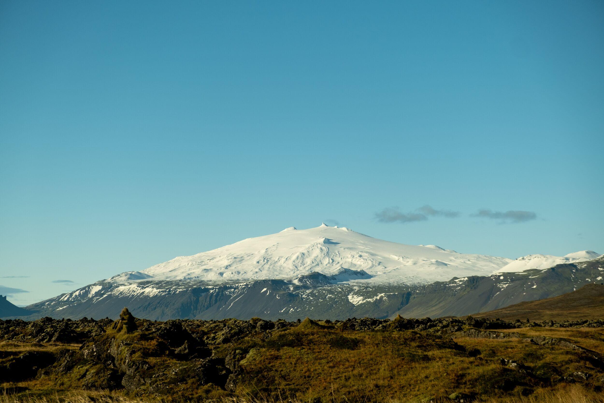
Saefellsjökull Glacier & National Park
Rising in the distance, Saefellsjökull dominates the peninsula. The glacier-covered volcano stands alone, watching over the land. Jules Verne imagined it as the entrance to the earth’s core in Journey to the Center of the Earth, and some people still believe it has mystical energy. Whether or not that’s true, it’s a breathtaking sight.
The national park that surrounds it is filled with trails, lava fields, and hidden caves. You don’t need to climb the glacier to appreciate it—just seeing it on the horizon, white against the deep blue sky, is enough.
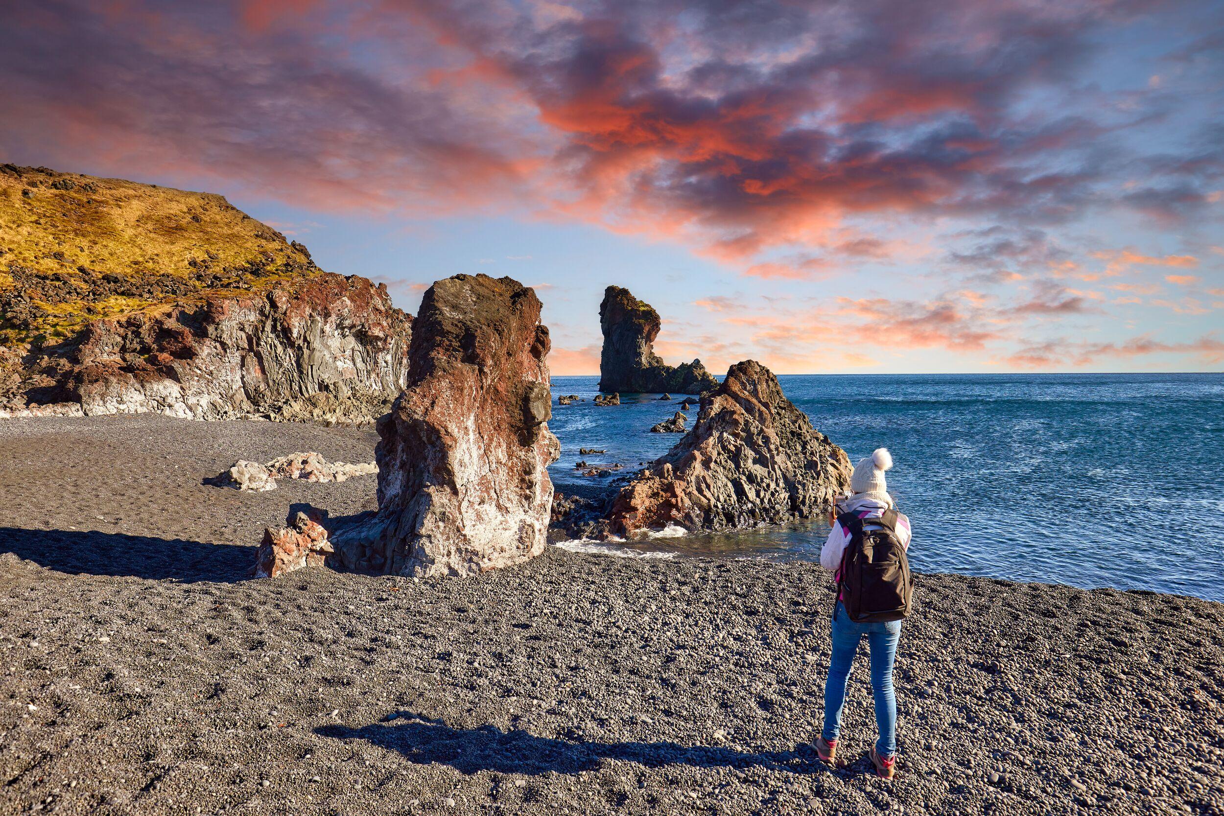
Djúpalónssandur Black Sand Beach
The road leads to the coast again, to Djúpalónssandur, a beach of black stones worn smooth by the tide. This is not a beach for swimming—it’s wild and rough, with waves that pull hard and fast. Scattered across the sand are the remains of an old shipwreck, twisted metal rusting in the salty air. It’s a reminder that this coastline has never been easy to navigate.
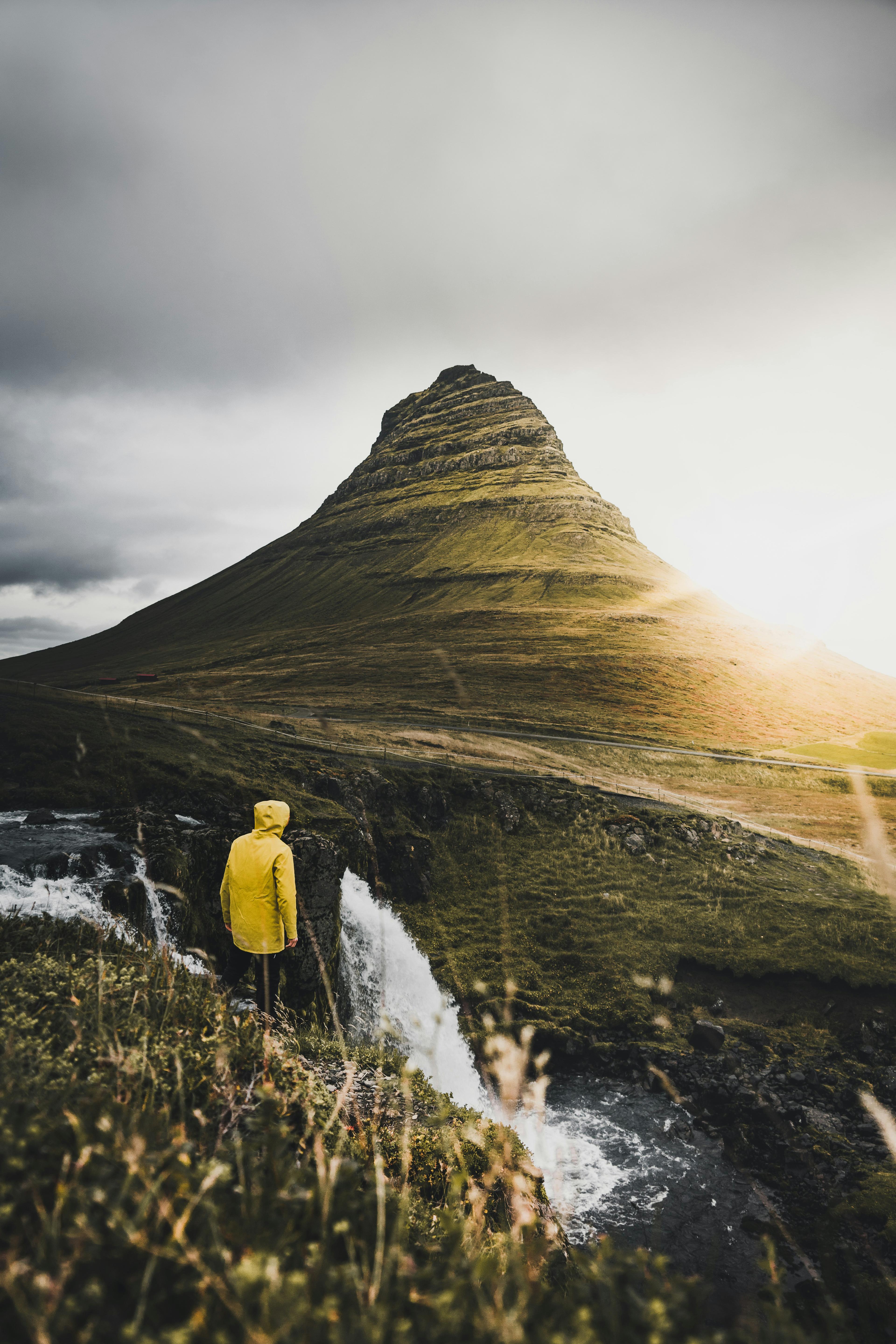
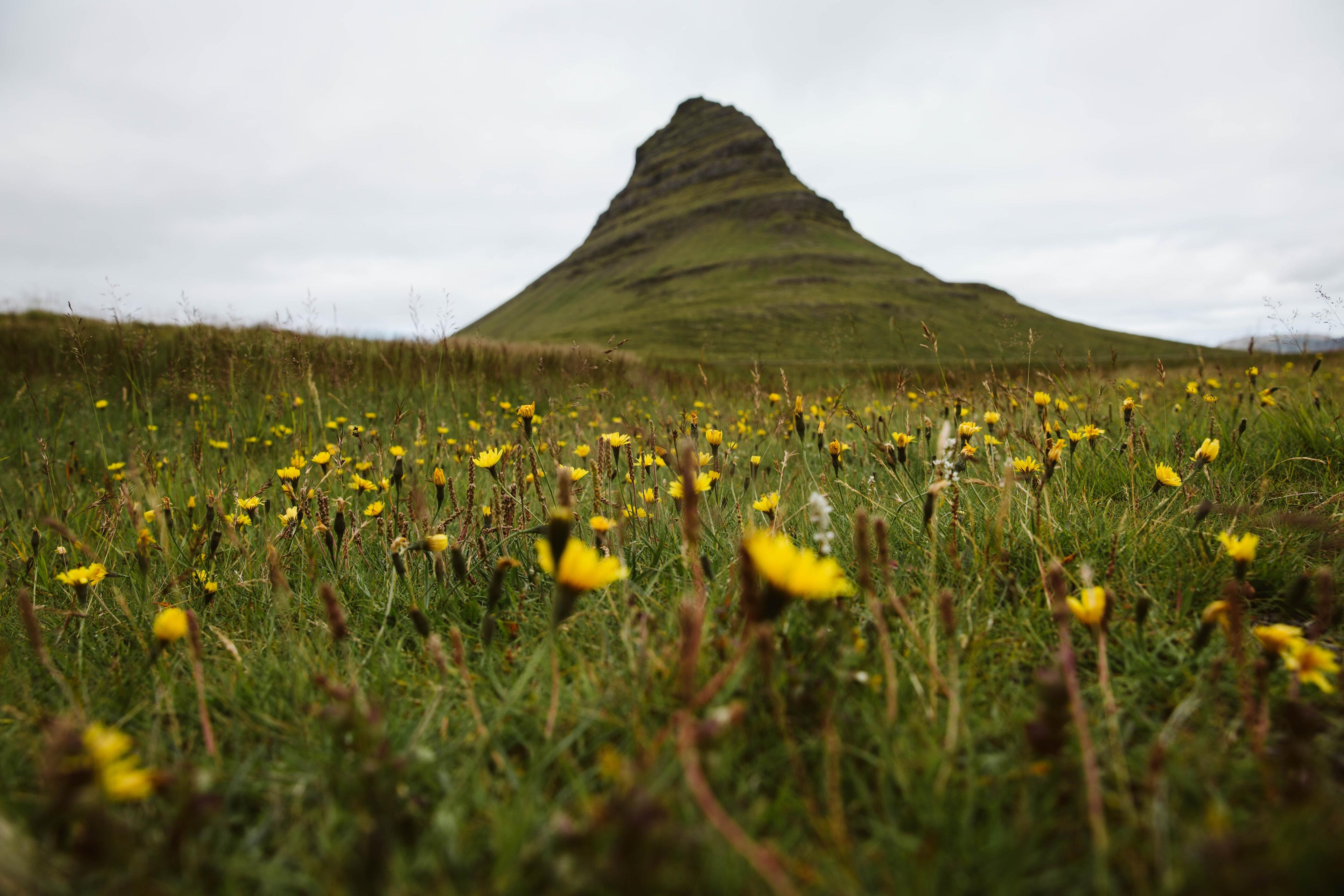
Kirkjufell & Kirkjufellsfoss
One of the bests highlights of Snaefellsnes is Kirkjufell, Iceland’s most photographed mountain. It stands alone, rising in a sharp peak, perfectly reflected in the nearby water. Next to it, Kirkjufellsfoss, a small waterfall, adds to the postcard-perfect scene.
You’ve seen it in photos. Maybe even in Game of Thrones. But standing there, watching the light shift over the mountain, it feels different.
Fishing Towns Along the Way
Beyond the wild landscapes and dramatic coastlines, Snæfellsnes is also home to small fishing towns that sit quietly by the sea, each with its own pace and history. These towns have long relied on the ocean, and while tourism has brought new visitors, fishing remains their heartbeat.
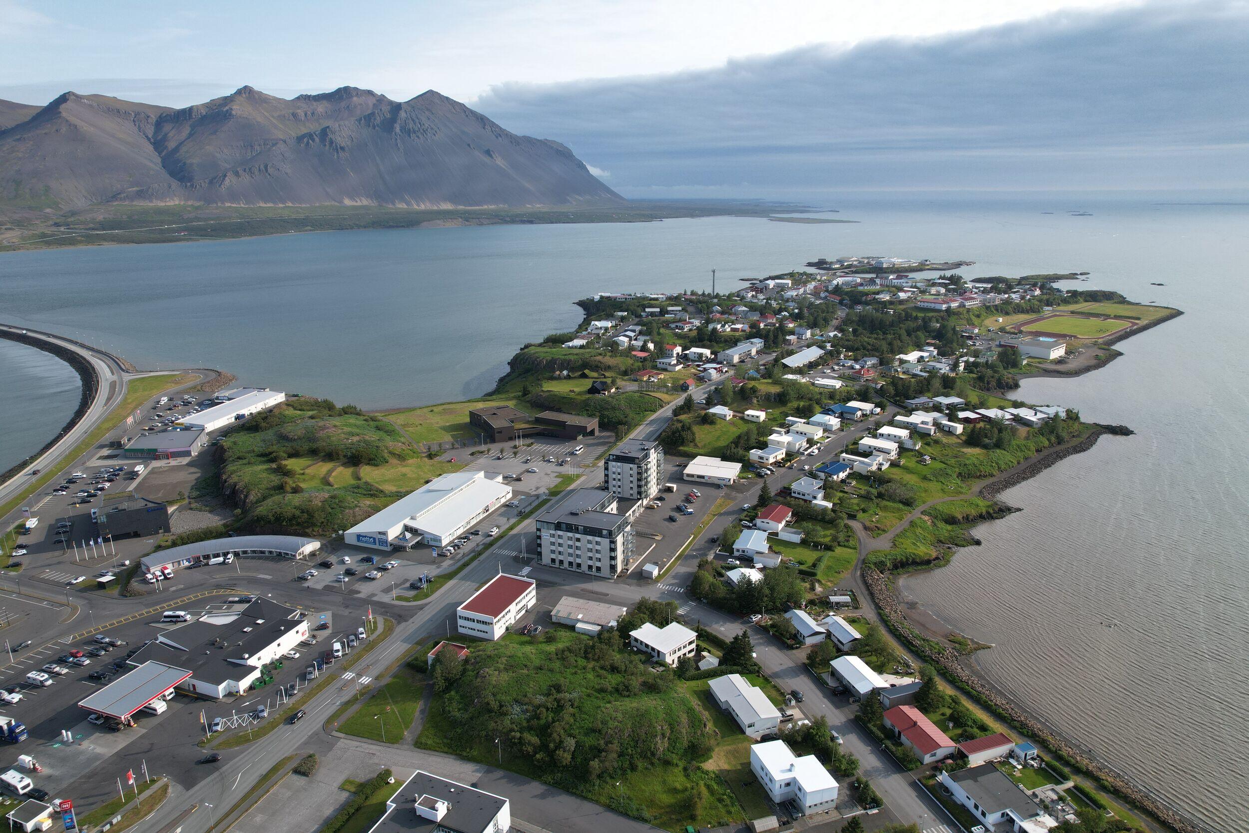
Stykkishólmur – The Gateway to the Westfjords
The largest town on Snæfellsnes, Stykkishólmur, is known for its colorful houses, a charming harbor, and a deep connection to the sea. It’s a practical stop—there are restaurants, shops, and even a modern geothermal swimming pool—but it also has history.
Perched on a hill overlooking the town is the Norwegian House, one of the oldest buildings in the area, now a museum. Just offshore, tiny islands dot the bay, part of Breiðafjörður, a vast fjord teeming with birdlife. From here, ferries leave for the Westfjords, making it a natural stopping point for travelers venturing further.
Grundarfjörður – Home of Kirkjufell
Just a short drive from Kirkjufell, Grundarfjörður is a quiet town with a picture-perfect setting. It sits between the sea and the mountains, where fishing boats bob in the harbor, and the town feels unhurried.
It’s small, but there are places to grab a meal and even a few spots to stay overnight. While the mountain steals the spotlight, Grundarfjörður itself is worth a stop—especially if you want to slow down and take in the scenery.
Ólafsvík – A Fishing Hub on the North Coast
Further west, Ólafsvík is another fishing town, sitting on the northern coast of the peninsula. It’s one of the oldest trading centers in the country, and even today, fishing is its main industry. The town has a simple, working-town feel, less polished than Stykkishólmur but just as welcoming.
One of the highlights is the Ólafsvík Church, an unusual modern design that stands out against the landscape. There’s also a small maritime museum, offering a glimpse into the tough lives of Icelandic fishermen. For those looking to explore the Snæfellsjökull area, it’s a good place to stop, refuel, and take in the northern views before continuing west toward the national park.
The towns of Snæfellsnes are small and quiet, shaped by the sea and the land. With a sparse population and wide-open countryside, life here moves at its own steady pace.
The Return to Reykjavík
The journey back follows the northern coast of Snæfellsnes, offering one last stretch of wide-open views. If time allows, there are a few more stops worth making.
For those who skipped Stykkishólmur earlier, now is a good time to explore its harbor and grab a meal. The town’s restaurants often serve fresh fish, caught just offshore. If the weather is clear, a short walk up Súgandisey Cliff offers a panoramic view over the fjord, with islands stretching toward the horizon.
From here, the road winds back toward Borgarnes, where many travelers take a final break before the last leg to Reykjavík. The town sits on a narrow peninsula, surrounded by water, and has a quiet, local feel. The Settlement Center here is a good stop for those curious about Iceland’s Viking history.
Back on Route 1, the drive south feels familiar, but the landscapes never seem the same twice. After a full day of exploring Snæfellsnes, Reykjavík comes into view, its skyline small but welcoming.
Saefellsnes is a journey through contrasts. The peninsula has a little of everything—Iceland’s volcanic power, coastal beauty, fishing heritage, and quiet wilderness.
For travelers who want something beyond the Golden Circle, Saefellsnes offers a different rhythm. It’s less crowded than the South Coast, more varied than Reykjanes, and packed with places that feel untouched.
This region is the perfect blend of famous, picture-perfect sights and off-the-beaten-path discoveries. Landmarks like Kirkjufell draw the photographers, but just as memorable are the quieter moments—the windswept black beaches, the lonely churches, the stillness of a fishing village at the edge of the sea.
Whether you seek Iceland’s iconic views or a sense of solitude, Saefellsnes offers both—without feeling rushed, without feeling crowded. Just Iceland, as it is.
Our small group tour provides an intimate experience, covering all the highlights of the Snæfellsnes Peninsula. Our knowledgeable guide will immerse you in the rich history and fascinating facts you need to fully appreciate this stunning region.
Questions and Answers about Snaefellsnes Peninsula
The Snæfellsnes Peninsula encapsulates the essence of Iceland’s natural beauty, cultural richness, and historical significance. Its varied landscape makes it an ideal destination for those who wish to experience the diversity of Iceland without travelling far from the capital. Whether you’re looking for adventure, tranquillity, or a journey through history, Snæfellsnes promises an enriching and unforgettable experience.
You might recognise the Snæfellsnes peninsula if you’ve ever looked closely at a map of Iceland. It is the long, narrow peninsula that sticks out into the Atlantic on the west coast of the island. To the north, it sits on Breiðafjörður Bay, while Faxaflói Bay (which stretches all the way to Reykjavík) lies on the south coast of the peninsula. Snæfellsnes is around 135 kilometres (83 miles) from Reykjavík and the drive is around two and a half hours.
To reach the Snæfellsnes Peninsula, you can drive from Reykjavík, which is the most common starting point for trips to the peninsula. The drive typically takes about 2 to 2.5 hours one way, depending on the route and weather conditions. You'll want to head north from Reykjavík on Route 1 before turning onto Route 54, which will take you along the southern edge of the peninsula.
Alternatively, for those who prefer not to drive, there are organized day tours available from Reykjavík. These tours often include transportation and a guide who can provide insights into the area's unique geology, history, and folklore. Day tours can be a convenient and informative way to experience the highlights of Snæfellsnes without the need to navigate or plan an itinerary yourself.
The best time of year to visit Snæfellsnes depends on what you want to do when you get there. If spotting puffins is on your bucket list, then visiting Snæfellsnes between May and August is the best time of year when the birds are most active and you might see little puffin chicks. If hiking on the Snæfellsjökull glacier is your top priority, you’ll want to visit in the summer months when the daylight hours are at their longest, giving you the most time for the hike. Between September and March, glacier hikes do not run on Snæfellsjökull. Whale watchers should consider visiting Snæfellsnes between December and April when you’re most likely to spot orca whales out in Breiðafjörður Bay. Winter can be a beautiful time of year to visit the peninsula, when Kirkjufell mountain is covered in snow and you have the chance to spot the Northern Lights in the long hours of darkness, away from the lights of Reykjavík.
It really depends on how much time you have. Seeing most of the region’s highlights on a day tour is possible. Some travellers spend an afternoon in Snæfellsnes, while others plan for multiple days.
Perhaps stop off at the Gerðuberg cliffs, which are formed from striking basalt columns, like the kind you might see at Giant’s Causeway in Northern Ireland. Check out traditional Icelandic architecture at Búðakirkja – a dramatic black wooden church that sits within a lava field. But the most iconic sight on the peninsula is Kirkjufell Mountain which has featured in Game of Thrones and makes for a beautiful photograph due to its bright green hue, conical shape and ocean backdrop. There’s also plenty of opportunity to see wildlife at Snæfellsnes, like seals on Ytri Tunga beach, arctic terns and kittiwakes on the dramatic sea cliffs of Arnarstapi, and whale watching and puffin spotting boat trips from Grundarfjörður.
Driving the entire Snæfellsnes Peninsula, following the main road that loops around, takes about 3 to 4 hours without stops. However, you might want to allocate a full day or more with stops at significant sights to enjoy the area thoroughly.
There are plenty of overnight accommodation options across the Snæfellsnes peninsula, from guesthouses and cabins out in the stark wilderness to hotels and B&Bs within walking distance of restaurants and shops. Stykkishólmur is the largest town on the peninsula, so it has the widest selection of accommodation and a handful of restaurants and grocery shops. You can also find campsites across the peninsula and places to stay in the heart of the wilderness. Almost at the very tip of the peninsula, there are a few places to stay around Arnarstapi where the dramatic rock features of the coastline attract keen hikers.
From Keflavik Airport, it is around 178 kilometres (111 miles) to the Snæfellsnes peninsula. Driving to Snæfellsnes from Iceland’s main airport takes approximately two hours and twenty minutes.
Don’t let the ‘æ’ intimidate you, Snæfellsnes is quite an easy Icelandic word to pronounce. It is said like Snay-fell-snes.
The Snæfellsnes peninsula is a great place to take the kids on a day’s adventure – you can introduce them to Icelandic folklore and let them experience the island’s unique scenery in one small space. There are short hikes suitable for families with kids and a smattering of towns and villages to stop and refuel throughout the day. You can rent a family-sized car and drive to Snæfellsnes peninsula yourself, or join a family-friendly Snæfellsnes peninsula tour that departs from Reykjavík.
The main thing you’ll want to do on Snæfellsnes peninsula is to explore the varied landscape – ice caps, lava fields, basalt cliffs and rugged hills. Those seeking active adventure can join a glacier hike at Snæfellsjökull National Park or perhaps descend into an 8,000-year-old lava tube at Vatnshellir Cave. If taking it easy is more your thing, you can embrace Iceland’s bathing culture in naturally-heated pools at Landbrotalaug hot springs. A different kind of bravery is involved at Bjarnarhöfn Shark Museum where you can try the famous Icelandic delicacy of hákarl, aka fermented shark.
Snæfellsnes is not on the route of the Golden Circle, but it has its own selection of natural highlights. Day trips around the Snæfellsnes peninsula also leave from Reykjavik and some say the landscape is just as beautiful as along the Golden Circle. Stops along the Snæfellsnes peninsula include chasing tumbling waterfalls, the possibility of a glacier hike at Snæfellsjökull, visiting pretty fishing villages and spotting puffins on clifftop walks.
Apart from Stykkishólmur, the largest town on the peninsula, Grundarfjörður is a good option for an overnight stay. There’s a selection of simple hotels, guesthouses and apartments, a couple of places to eat and plenty of things to do on your doorstep. Whale watching tours out into Breiðafjörður Bay leave from Grundarfjörður’s little harbour and from the town, you can walk to the famous Kirkjufell mountain. Ólafsvík is another coastal town on the north shore of the peninsula where a scattering of simple hotels, hostels and apartments sit by the sea.
If you are planning a Snæfellsnes Peninsula self-drive from Reykjavík, you’ll need to take the main Route One road from the capital to Borgarnes and then join Road 54 to reach Snæfellsnes. Both are main roads and are often cleared of snow in December, but winter driving in Iceland can be challenging in general, especially if you get caught in a blizzard. The Snæfellsnes peninsula can experience high winds in winter. Always check the SafeTravel app before you leave to keep up to date with road closures and weather warnings. The safest and easiest way to get to the Snæfellsnes peninsula in December is to join an organised tour from Reykjavík. Let someone else take care of the driving and itinerary so all you have to do is enjoy the scenery.
Jutting out into the North Atlantic Ocean, there is often a bracing wind blowing across the Snæfellsnes peninsula, so dressing in a waterproof windbreaker jacket is a good idea. It’s all about outdoor adventures here and most people visit to hike along cliff tops or take a boat out to spot puffins and whales. In winter, you’ll want to wrap up warm with layers of woolly jumpers, hats, scarves and gloves, maybe even thermal layers in the coldest months. Sturdy, waterproof walking boots are the best footwear for Snæfellsnes.
Close to the Snæfellsnes peninsula and on the way to and from Reykjavík, there are plenty of must-see attractions. You can pause to refuel and refresh at Borgarnes and admire the beauty of the area around the Borgarfjörður fjord where the majority of the Icelandic Sagas were set. The nearby region of Húsafell is a short drive from Snæfellsnes where you can bathe in the naturally heated water of the Krauma Spa, which is geothermally powered by Europe’s most powerful hot spring. In Húsafell, you’ll also find Iceland’s second largest glacier, Langjökull. Here, you can embark on a monster truck adventure onto the glacier’s surface or explore a man-made ice tunnel through the glacier which is open year-round.
The Snæfellsnes Peninsula is an excellent spot for viewing the northern lights when it is dark enough, with no cloud cover and plenty of solar activity, thanks to its dark skies and minimal light pollution.
A great stopping point between Akureyri and Snæfellsnes is Hvammstangi, known for its seal-watching opportunities, or the historic town of Stykkishólmur on the peninsula’s north side.
Snæfellsjökull translates to “Snow Mountain Glacier” in Icelandic, referencing its prominent snow-covered peak visible throughout the year.
Snæfellsjökull is considered a dormant volcano, having last erupted around 1,800 years ago, and is not currently active.
There is no entry fee for Snæfellsjökull National Park itself, but guided tours, especially those involving glacier hikes, can vary in cost based on the provider and length of the tour.
Yes, you can climb Snæfellsjökull, which is one of Iceland's famous glaciers and located on the Snæfellsnes Peninsula. Climbing Snæfellsjökull is a popular activity for those visiting the area, offering a chance to experience the stunning views from atop the glacier.
The climb is typically done as a guided tour, which is highly recommended due to the challenging nature of glacier hiking and the specific safety equipment required, such as crampons and ice axes. These guided tours also provide valuable insights into the glacier's geography and the surrounding environment.
The hike itself can be quite demanding and is suitable for those in good physical condition. The weather can also significantly affect the climb, so it's important to be prepared for sudden changes in conditions and temperatures. Climbing Snæfellsjökull provides a unique adventure and a panoramic view of the surrounding landscapes, making it a memorable part of visiting Snæfellsnes.
You can see Snæfellsjökull from Reykjavík on a clear day even though it is out on the Snæfellsnes peninsula, nearly 120 kilometres from the capital as the crow flies. This is because the Snæfellsnes peninsula curls around the bay of Faxaflói. Of course, with Iceland’s notoriously wild weather, getting a clear day in Reykjavík is not that common.
Snæfellsjökull rose to fame after it was featured in Jules Verne’s book Journey to the Centre of the Earth as the intrepid explorers climbed the glacier to enter the chasm into the Earth’s core.
There must be something other-worldly about Snæfellsjökull because in November 1993 a group of people gathered on top of Snæfellsjökull to welcome aliens to Earth. The group sang songs and held hands, but there is no video or photographic evidence that the aliens visited Snæfellsjökull that day.
Snæfellsjökull stands at 1446 metres above sea level and it is the 8th highest glacier in Iceland.
On a clear day, you can see the white expanse of Snæfellsjökull from Reykjavík.
In terms of driving distance, Snæfellsjökull is 198 kilometres (around 123 miles) from Reykjavík and it takes approximately three hours to get here by car. If you are driving yourself from Reykjavík, you will need to follow the Route One main road north out of the capital and change onto Road 54 at Borgarnes. This road leads along the length of the Snæfellsnes Peninsula and turning onto the F-570 road near Arnarstapi will see you at the base of Snæfellsjökull glacier.
While the ‘æ’ might look strange to an English speaker, pronouncing Snæfellsjökull is quite easy. It is said like Snay-fells-yeh-kohl. The ‘ö’ is pronounced like a vowel somewhere between an ‘e’ and an ‘a’ and the ‘j’ in Icelandic words is usually said softly, more like a ‘y’ in English.
It is possible to climb to the summit of Snæfellsjökull which stands at a mighty 1446 metres above sea level. However, most guided glacier hikes stop at 1418 metres where the view out over the Snæfellsnes peninsula is just as glorious. The final metres to the summit are a steep slope of ragged rock and ice which is a big challenge, but it can be done.
The Snæfellsjökull glacier is a vast ice cap, sitting atop a stratovolcano. While Iceland is constantly simmering with volcanic activity, the last eruption of this particular volcano was over 1,800 years ago. Snæfellsjökull is considered an active volcano as it has the potential to erupt in the future.
The entire hike across Snæfellsjökull tends to take between 3 and 6 hours and the first 40 to 60 minutes of that involves the walk to the beginning of the glacier from the car park and base. So, altogether you would spend around 2 and 4 hours on Snæfellsjökull itself.
The volcanic range that contains Snæfellsjökull is estimated by geologists to be around 700,000 years old. The ice cap itself will have been formed over thousands of years, but the exact date of its birth is difficult to pinpoint. Snæfellsjökull and the surrounding area was declared a national park in 2001.
In terms of glacier hikes in Iceland, the Snæfellsjökull hike is quite a long distance. The entire route is between 7 and 8 kilometres and tends to take between 3 and 6 hours to complete, depending on snow conditions. It involves a total of 760 metres (about 2,500 feet) of climbing and you’ll need professional equipment like crampons, ice axes and helmets to make the hike. The Snæfellsjökull route is considered a challenging hike, so you’ll need a decent level of fitness and need to be ok with walking up steep ascents in difficult conditions. It is worth noting that glacier hiking in Iceland can only be done under the guidance and supervision of a professional hiking guide, so you cannot embark on a Snæfellsjökull glacier hike on your own.
For those that enjoy outdoor adventures, the Snæfellsjökull glacier is definitely worth visiting. It is the only place on the Snæfellsnes peninsula where you can embark on a glacier hike and those that summit this vast ice cap are rewarded with expansive views of the surrounding volcanic landscape. Hiking Snæfellsjökull is certainly a challenging ordeal and would best suit those with a bit of hiking or climbing experience. However, if you’re enjoying a self-drive adventure along the Snæfellsnes peninsula, it is worth pausing at the base of Snæfellsjökull just to admire this natural wonder from ground level. There is a Snæfellsjökull viewpoint along the peninsula’s main road which is marked on Google Maps.
The average hiking time for Snæfellsjökull depends on snowfall and season. When the glacier is frozen and there is little snow on top of the ice cap, the hike tends to take between 3 to 5 hours. However, when there is deep snow to navigate, the hike can take between 5 and 6 hours.
Snæfellsjökull National Park is one of three national parks in Iceland. While each park is staffed with rangers who are there to provide information and keep you safe during your visit, there is no fee to enter any of the national parks on the island. So, it is completely free to go to Snæfellsjökull National Park. It is also free to use the Snæfellsjökull visitor’s centre where you can find information about hiking and things to do in the area.
You may recognise Kirkjufell from the hit series, Game of Thrones. In the show, it’s known as Arrowhead Mountain, a key landmark behind the Wall.
The atmospheric location is supposed to be the birthplace of the Night King and it can be seen in season 6.
Kirkjufell was a nunatak, a mountain peak that would have once emerged through the surface of a surrounding glacier. If you see photos of nunataks, you’ll notice their summits poking through the ice. In the case of Kirkjufell, the peak was eroded by two separate glaciers.
Typically, nunataks are formed because they are harder and more resistant to erosion than surrounding rocks. For example, Kirkjufell contains volcanic rock which was better able to withstand the glacial erosion.
Kirkjufell is pronounced more or less how it’s written in English. There are just a few things to look out for if you want to get the Icelandic pronunciation exactly right.
Firstly, pronounce the “i” in “kirk” like an “i” sound, rather than “u” you might use in English. Then soften the “j”, so it is more like a “y”. Finally, the double-L in Icelandic is usually pronounced more like “tl”, with a soft T sound.
Kirkjufell is one of the best-known mountains in Iceland. Here are some key facts that you should know:
- Firstly, it’s said that Kirkjufell is the most photographed mountain in Iceland. Professional and amateur photographers come to capture its unique shape and its spectacular location next to the ocean.
- Kirkjufell would once have been almost entirely covered by glaciers. Only its irregular top would have emerged from the ice’s surface.
- There’s a local legend of a woman who lived with her two sons on the Kirkjufell farm. When the sons both drowned in Kirkjufellsfoss waterfall when fishing, she cast a spell so that no one would ever drown in the river again—but that no one would ever catch a fish in the river either.
Kirkjufell reaches a height of 463 metres (1,500 feet) above sea level. To reach the summit, the path starts at sea level.
Kirkjufell translates as “Church Mountain”. It’s so named, thanks to its distinctive shape.
However, many say it looks more like a witch’s hat. Meanwhile, Danish sailors originally referred to the mountain as Sukkertoppen, or “The Sugar Top”.
Kirkjufell is 463 metres (1,519 feet) high and the path to climb it starts from the car park at the side of the road 54. While it’s a very direct route up to the top of the mountain, it is a climb so only seasoned mountain climbers with the appropriate equipment, such as ropes, should consider ascending to the summit. Sadly, this mountain has witnessed fatalities when individuals overestimated their climbing abilities.
You don’t need to pay to see Kirkjufellsfoss itself, but you will need to pay for parking. That costs 700 ISK.
Alternatively, you can forget about the car and join a tour of the Snæfellsnes peninsula instead. We’ll take you to all of the highlights of the peninsula, including Kirkjufell, Arnarstapi village, and the mighty Snæfellsjökull glacier.
There are three different car parks at Kirkjufell and Kirkjufellsfoss. All of them charge for parking. You can expect to pay 700 ISK to leave your car there. That’s equivalent to about 5 US dollars.
Kirkjufell was formed thanks to an ancient volcanic eruption. The summit of the mountain is made from tuff, a hard volcanic rock that is created when volcanoes erupt beneath glaciers. The rapid cooling of that rock causes its ragged shape.
As a result, the volcanic rock once would have protruded from the top of surrounding ice caps. As the softer rock eroded, we were left with this strange form that rises high above the surrounding landscape.
Kirkjufell is known as the most-photographed mountain in Iceland. While there’s no way of knowing whether that’s true, there’s no doubt that it’s a truly iconic mountain.
You’ll understand why when you see it. Kirkjufell’s magnificent ridge towers over the surrounding coastal landscape. In fact, its name, “Church Mountain” is inspired precisely by this imposing form. Kirkjufellsfoss, the magical waterfall close by, adds an extra dimension to this spectacular view.
And to give it an extra star quality, Kirkjufell also appeared in Game of Thrones, in which its known as the Arrowhead Mountain.
Kirkjufell is one of Iceland’s most iconic sights. From a distance, its unique shape rises abruptly from the surrounding landscape. From the top, it offers breathtaking views of the sea and land.
If you’re an outdoor enthusiast, a trip up to its summit is an awe-inspiring experience. And if not, Kirkjufell is a splendid photo opportunity when you’re on the Snæfellsnes peninsula.
Kirkjufell is the sole peak on a little peninsula that juts out into the Breiðafjörður, the fjord that separates Snæfellsnes from the Westfjords. You can walk around this peninsula on a coastal path, giving you excellent views of Kirkjufell from every angle.
The circular trail from the car park is about 6.5 kilometres (4 miles) and can be completed in under 2 hours.
Tackling Kirkjufell isn't a task to be taken lightly. While the climb is relatively short, the journey is exceedingly steep. It typically requires about 1.5 hours to reach the summit, and the descent follows the same challenging path.
The route up this stark and imposing mountain is not only steep but also alarmingly exposed, necessitating a strong head for heights and nerves of steel. It's crucial to be equipped with proper climbing shoes providing excellent grip - city trainers simply won't suffice on this demanding terrain.
On top of this, please bear in mind that it's not just a challenging hike, it's an actual climb. This means that appropriate climbing gear, including a harness and rope, is absolutely essential for your safety. It isn't a mere walk-up, and it's not suitable for average hikers.
Respect for the weather conditions is crucial. If faced with strong winds and rain, Kirkjufell transforms into an extremely difficult, potentially deadly mountain to climb. Tragically, there have been fatal accidents in the past, which serve as a solemn reminder of the mountain's dangers. If you've begun the climb and feel uneasy, it's always safer to descend than to continue upward.
As a result of these hazards, access to this mountain is now strictly limited. It's only open during the summer months, and even then, it's only recommended for experienced climbers.
Related Attractions
Related Articles
See all articles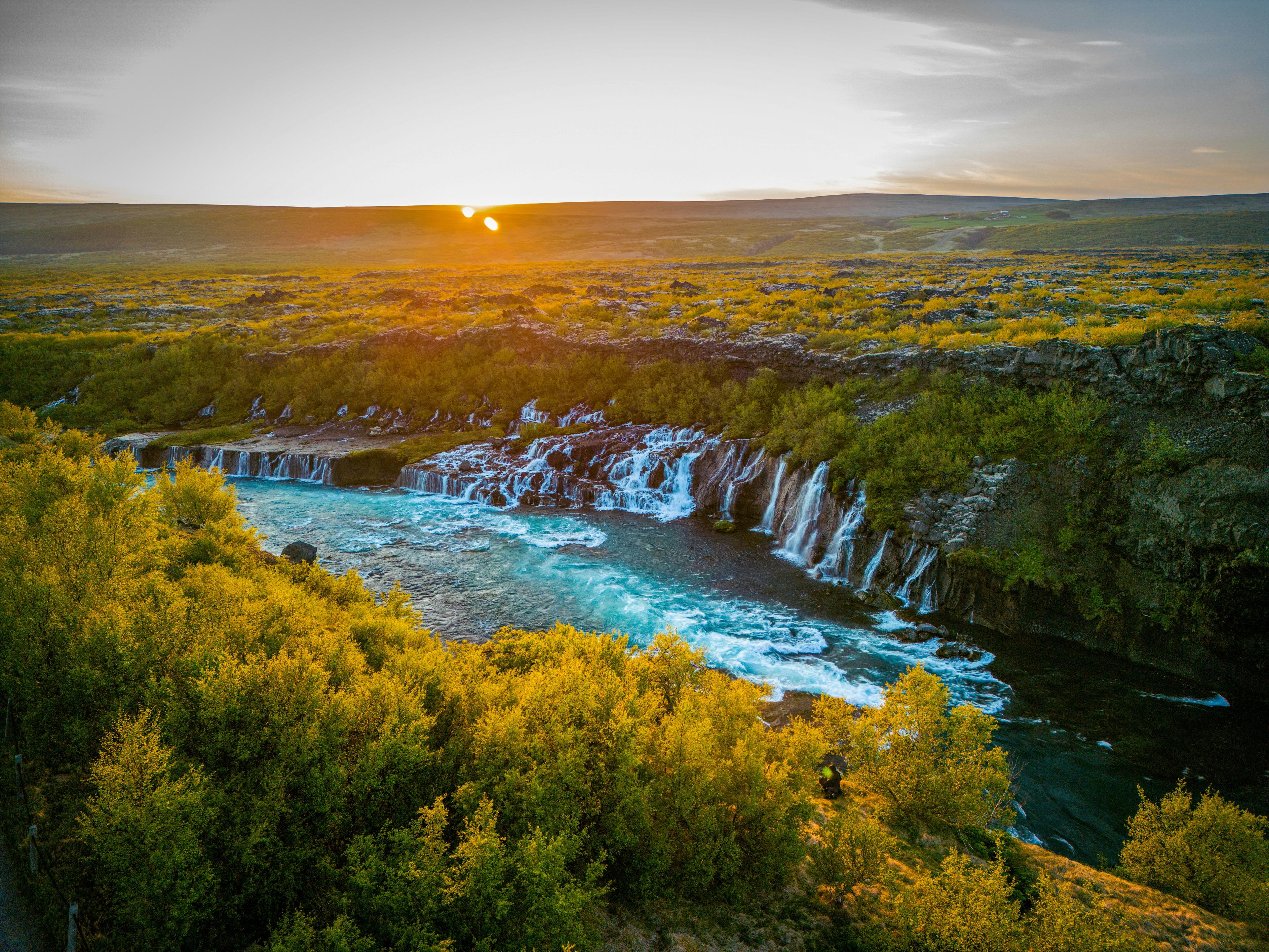
Recommended tours
Wonders of Snaefellsnes Peninsula - Small Group Tour
Saefellsnes peninsula is called "Iceland in Miniature" for a good reason: the region showcases raw beauty, glacier-capped volcanoes, postcard-worthy landscapes, dramatic cliffs, black sand beaches, and charming fishing villages. Yet, unlike other popular day trips from Reykjavík, it offers something rare: solitude. With fewer visitors, it’s the ideal escape for those seeking Iceland’s breathtaking scenery without the crowds.
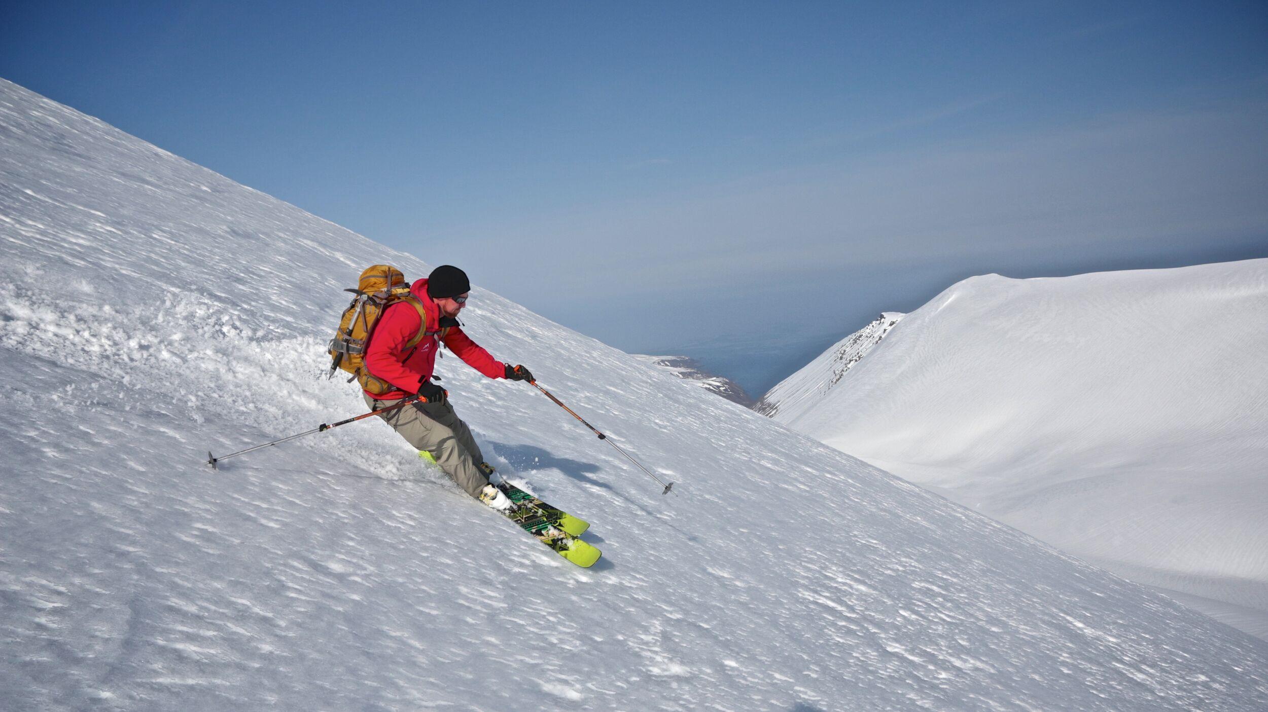
Mountains and Fjords of the North
Embark on an exhilarating 6-day ski adventure on Iceland’s legendary Tröllaskagi Peninsula. Known for its stunning fjords and challenging terrain, this tour is perfect for experienced skiers seeking the ultimate combination of epic runs, breathtaking views, and adventure.
Snæfellsjökull Summit Hike
This is a thrilling one-day hike to the summit of Snæfellsjökull glacier, the crown jewel of the Snæfellsnes Peninsula. This challenging journey rewards hikers with breathtaking views, fascinating geological formations, and the triumphant feeling of conquering one of Iceland's most picturesque glaciers.
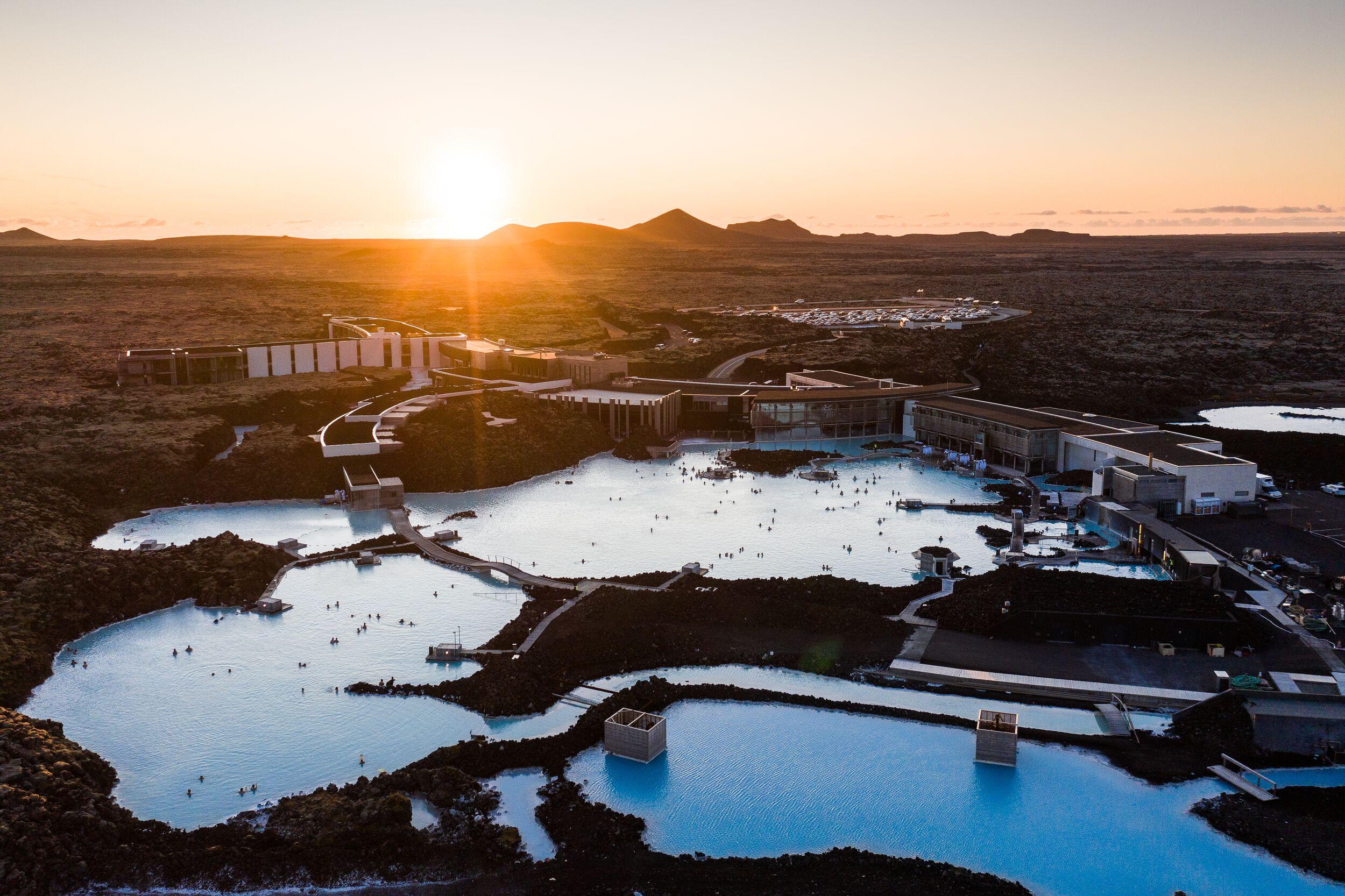
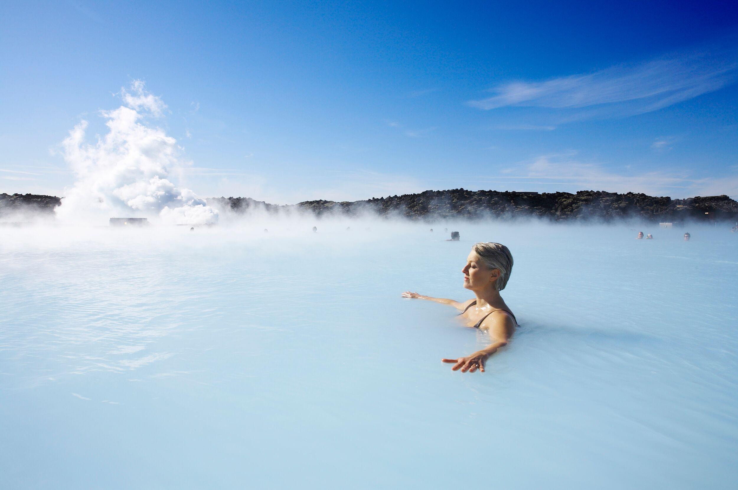
Volcanic Wonders with Grindavik Visit & the Blue Lagoon
Embark on a carbon-neutral journey through Iceland’s stunning volcanic landscapes. Enjoy a refreshing hike across a lava field, formed by recent eruptions, and then unwind with a soothing soak in the healing geothermal waters. This perfect combination of adventure and relaxation offers an unforgettable way to experience the raw power and serene beauty of Iceland’s natural wonders.
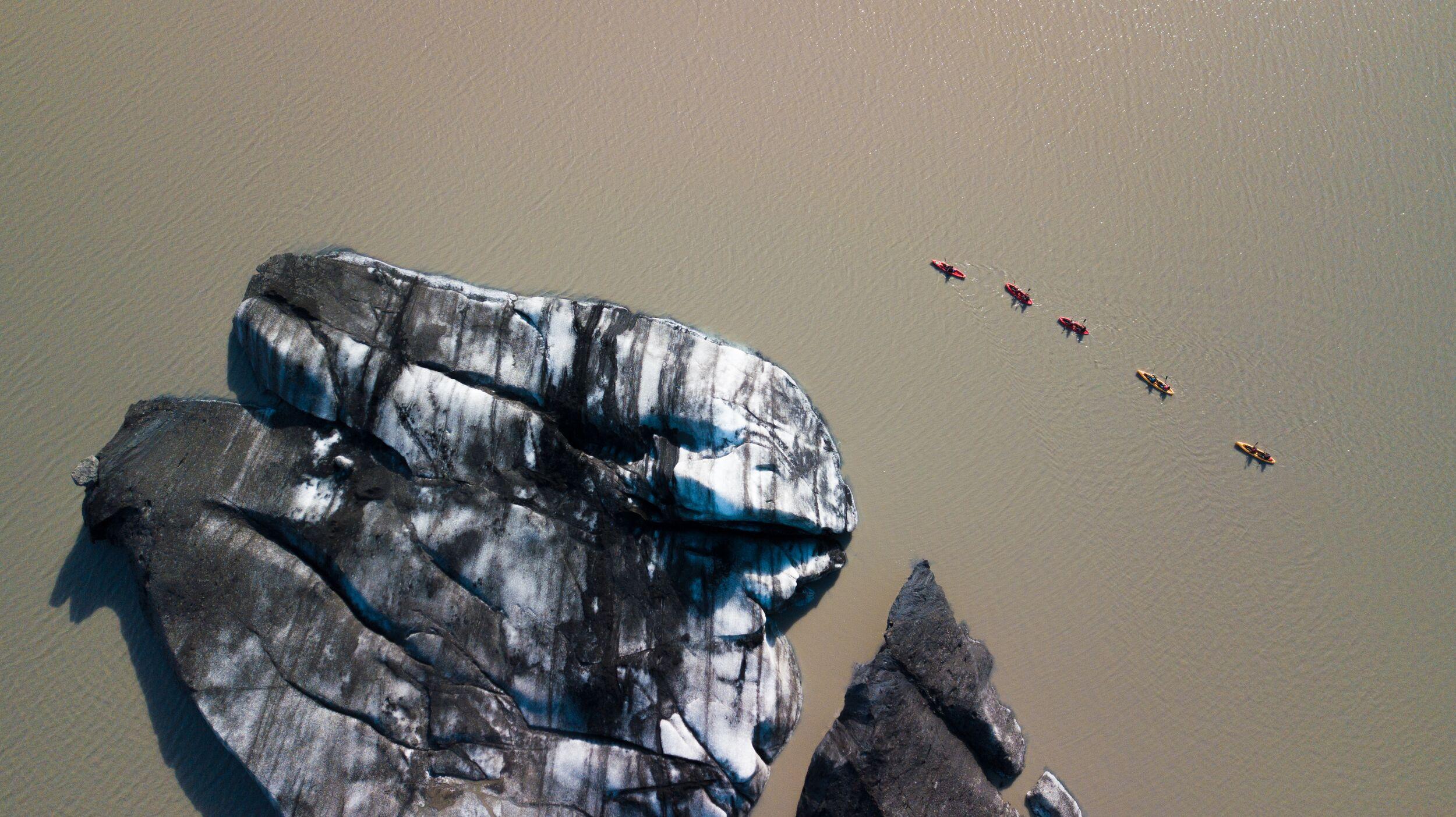
South Coast & Glacier Kayaking
Discover the essence of Iceland's natural beauty on this day tour, featuring two of Iceland's most renowned waterfalls and an exhilarating kayaking experience on a glacier lagoon. Journey through landscapes that blend cascading waters with icy wonders, all in a single, unforgettable day.
- Best seller
- Popular
Blue Lagoon & Northern Lights
Enjoy a perfect winter day in Iceland! Experience the best of Iceland with this package of two of the island’s most popular tours in one day! Soak in the milky blue healing water of the Blue Lagoon, which is one of Iceland's most famous tourist attractions and is considered by many to be a once-in-a-lifetime experience and an unmissable part of a visit to Iceland. After your return to Reykjavík, a guide will lead you on a search for the elusive northern lights! Watching the lights dance and flicker in the sky, changing shape and colour, is incredible. Prepare to be dazzled!