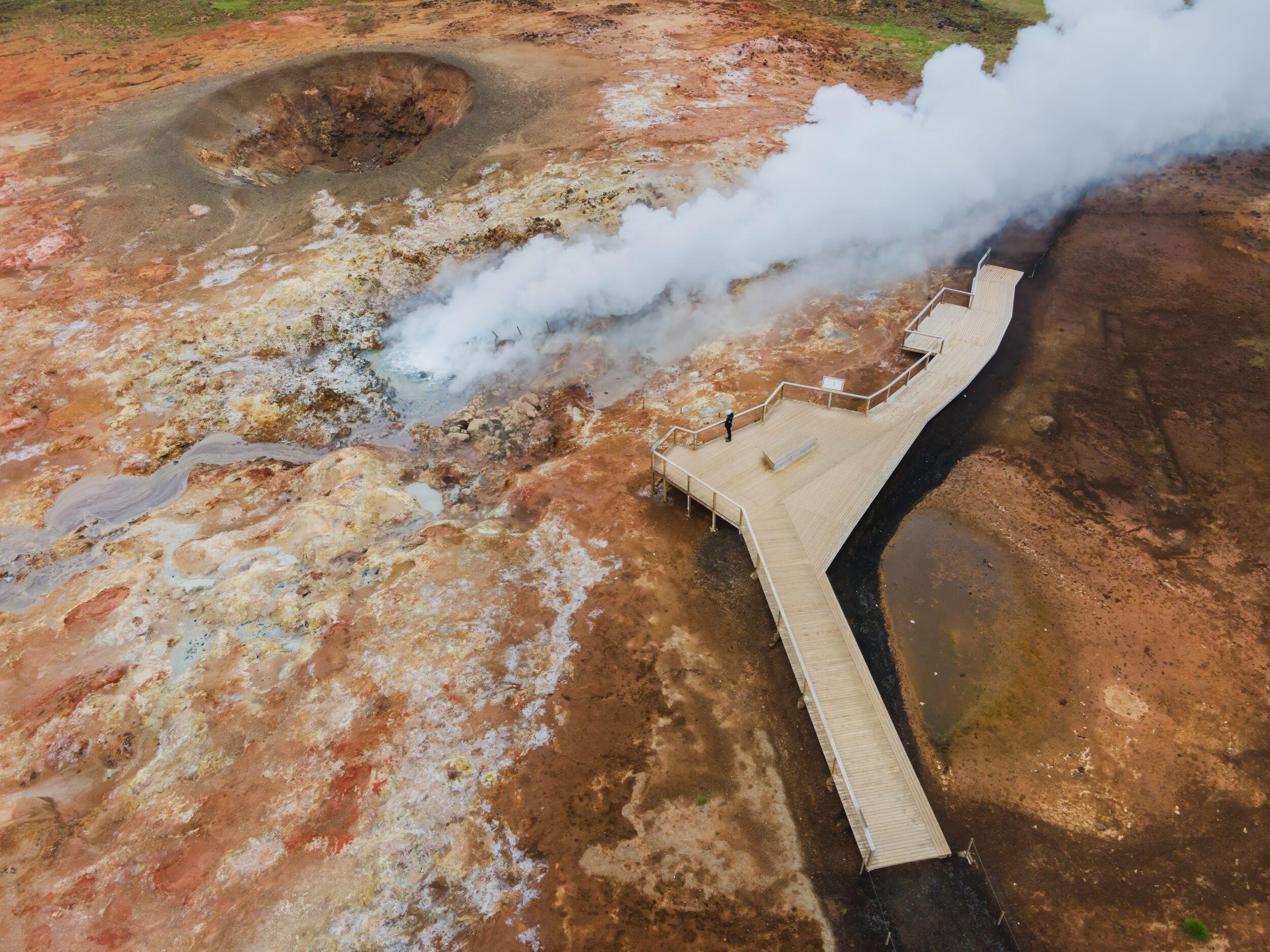
Known as the home of the Blue Lagoon and a pair of recent erupting volcanoes, the Reykjanes Peninsula was recognized as a UNESCO Global Geopark in 2015. UNESCO Global Geoparks are areas where landscapes and specific sites are of international geological significance and are managed with a concept of preservation, education, and sustainable development. The geopark is an excellent representation of Iceland’s unique geology and is a must for geology enthusiasts, hikers, and photographers.
The Reykjanes Peninsula is a young section of Iceland, a highly volcanic counterpart of the Mid-Atlantic Ridge, where the North American and Eurasian tectonic plates part at an average rate of a couple of centimeters a year. This is the area to explore a volcanic wonderland.
Geology and landscape of the Reykjanes Geopark
The Reykjanes Peninsula, with an area of 2,000 sq. km, comprises four volcanic systems and fissure swarms from the southwest to the northeast. They contain open fissures, faults, geothermal fields, and dormant volcanic fissures.
Eruptions have occurred in the three systems during the past millennium, all in long episodes, in the 10/11th centuries, in 1151-1180, 1210-1240, and most recently in 2021 and 2022.
Sites in the Reykjanes Geopark
Fifty-five various sites make up the Reykjanes Geopark. Below are some natural sites to visit.
Bridge Between the Continents
Travelers can visit a spot where the Mid-Atlantic Ridge crosses Iceland, the meeting point of the Eurasian and North American plates. There’s a small footbridge, a symbolic site that connects the two land masses, offering visitors an impressive view of the ridge.
Gunnuhver
Gunnuhver is a geothermal area comprised of bubbling mud pools, hissing steam vents, and colorful mineral deposits. It is named after a legendary ghost named Gunna, and the area offers a fascinating view of Iceland’s geothermal activity.
Kleifarvatn
Kleifarvatn is a vast lake known for its dark, mysterious waters and spectacular volcanic surroundings. It is the largest lake on the Reykjanes Peninsula and offers locals and travelers opportunities for hiking, fishing, and birdwatching.
Garðskagaviti
The highlights of Garður for many are the two lighthouses, each with unique charm. The more traditional and older red-striped lighthouse was built in 1847, while the newer square-shaped lighthouse was built in 1944 in a more modern Nordic style. Fishing boats can often be seen from shore, and there is rich birdlife in the region, ranging from hordes of gulls circling in the summer months to ravens dominating the skies in the winter.
Reykjanesvötn
Reykjanesvötn is a cluster of volcanic craters and lakes, displaying the geological diversity of the Reykjanes Peninsula. The area offers scenic hiking trails and an opportunity to observe volcanic formations up close.
Seltún
Seltún is a geothermal area in Krýsuvík, featuring an otherworldly landscape with gurgling mud pots, boiling vents, and rich mineral deposits. Wooden footpaths allow visitors to explore the geothermal features while ensuring their safety.
Krýsuvíkurbjarg
This dramatic sea cliff offers breathtaking coastline views and is home to nesting seabirds, including puffins, fulmars, and kittiwakes. It provides an excellent opportunity for birdwatching and enjoying the coastal scenery of the Reykjanes Peninsula.
Wildlife in the Reykjanes Geopark
While the Reykjanes Peninsula may seem desolate with its sweeping lava fields, it’s a region rich with wildlife. There are three mammal species that thrive on the Reykjanes Peninsula: Arctic foxes, minks, and field mice.
However, when it comes to birds, numerous species dominate the skies surrounding the Reykjanes Peninsula. Among the wilderness birds are Ptarmigans, Northern Wheaters, Snow Buntings, Golden Plowers, Whimbrels, and Ravens. There are also various swimmers and wetland birds like Mallards, Greylag Geese, Great Northern Divers, and Eurasian Oystercatchers; the birds of prey include both Merlins and Gyrfalcons. It’s no wonder Reykjanes is so popular among birdwatchers and wildlife photographers.
How to get to the Reykjanes Geopark
Guided Tours
Joining a guided tour is an excellent option if you prefer not to drive or navigate on your own. Some tour operators offer guided excursions to the Reykjanes Geopark from Reykjavik; these tours often include transportation, a knowledgeable local guide, and visits to key attractions in the geopark.
By Car
While guided tours are the way for many travelers, renting a car to explore the Reykjanes Geopark is possible. From Reykjavik, you can drive to the geopark by following Route 41 or Route 43, both of which connect the capital region to the Reykjanes Peninsula.
The best time to visit the Reykjanes Geopark
The Reykjanes Geopark can be a great area to visit any time of year. In summer, there could be milder temperatures, long days of sunlight, and lush green grass and moss covering the landscape. However, the winter is also a lovely time to visit the region with the soft light, possible snowy landscapes, and fewer crowds.
FAQ
Reykjanesviti to Valahnúkur
This easy coastal hiking trail begins at the towering Reykjanesviti lighthouse and leads to the dramatic Valahnúkur cliff. The path offers breathtaking views of the rugged coastline, sea cliffs, and the ocean. It’s an excellent opportunity for birdwatching and enjoying the coastal scenery.
Garður to Sandvík
This hiking trail along the sea starts at the village of Garður and takes you to the beautiful Sandvík beach. An easy hike, you’ll pass by picturesque coastal scenery, bird colonies, and the remains of an old fishing village.
Volcanic cone Keilir
Keilir is a distinctive volcanic cone; a moderately challenging hiking trail to the summit of Keilir offers panoramic views of the surrounding lava fields, coastline, and Reykjanesviti lighthouse.
This proximity to the airport makes the Reykjanes Geopark a convenient option for travelers with limited time in Iceland or those looking to explore the geologically rich landscapes of the Reykjanes Peninsula shortly after arriving or before departing the country.
Iceland’s combination of volcanic activity, tectonic processes, glacial and geothermal interactions, and unique geological formations make Iceland a remarkable destination for geologists, nature enthusiasts, and travelers seeking to experience the raw power and remarkable beauty of Earth’s geology.
In addition to its geological significance, the Reykjanes Geopark is rich in cultural and historical heritage. The region is home to charming fishing villages, towering lighthouses, historic churches, and remnants of early human settlements. The cultural heritage reflects the historical connection between people and the surrounding landscape.
The water isn’t deep, about 5 ft, and the bottom is covered with white silica mud, the result of a natural process of recondensation. It’s common to see visitors cover their faces with the mud—it’s excellent for your skin, and all guests receive a free silica mud mask with standard admission. The gift shop sells Blue Lagoon skin products with ingredients ranging from silica mud to algae found in other parts of Iceland.
The geopark was established in 2005 to promote and preserve the unique geological and cultural heritage of the Reykjanes Peninsula.
The Blue Lagoon is the most popular attraction on the Reykjanes Peninsula and arguably the most famous site in all of Iceland. Built on an 800-year-old lava field, the Blue Lagoon covers an area of 93,646 sq ft and draws visitors from around the world to soak in its gloriously milky-blue waters amid a dreamlike atmosphere. The geothermally heated water ranges between 37-39°C (98-102°F) and is heavenly any time of year.
Enjoying the steamy air while soaking during the summer is lovely, especially on sunny days. And in the winter, a visit here is eerie and fantastic; watching as snow falls from the jet-black December sky or as northern lights dance across it while lounging in hot water is sublime.
The most recent eruption in Reykjanes started in March 2021, near the Fagradalsfjall mountain. It marked the first eruption in this area in over 800. The eruption was dubbed a “tourist eruption “as it attracted significant attention due to its accessibility and the opportunity for people to witness the lava flows and volcanic activity up close.
The distance between Keflavík International Airport and the Reykjanes Geopark depends on the specific sites within the geopark you wish to visit. However, the geopark is generally easily accessible from the airport, and travel times are relatively short. For example, if you plan to visit famous sites such as the Bridge Between Continents and the Blue Lagoon, they are located within a 30-minute drive from the airport. Other attractions and trails within the geopark are also within a reasonable driving distance from the airport.
The geopark encompasses the southwestern part of the Reykjanes Peninsula, and Keflavik International Airport is on the peninsula’s western side.
The Reykjanes Geopark aims to promote sustainable development and raise awareness about geology, nature, and cultural heritage. It emphasizes the importance of conserving the natural and cultural resources of the region while providing educational opportunities for visitors and local communities.
Many Reykjanes Peninsula tours feature a visit to the Blue Lagoon. However, if you’re traveling independently, it makes sense to visit right after you fly in or before you head home, as it’s very close to Keflavík airport. A rejuvenating soak is a great way to kick off your trip or end it on a relaxing note.
Related tours
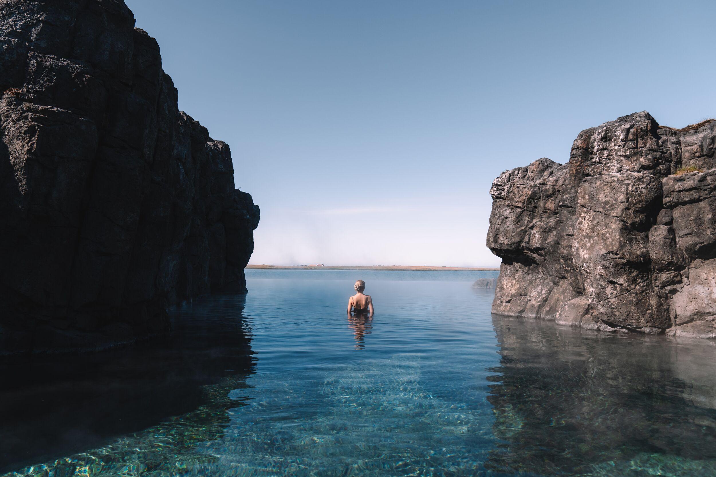
Volcanic Wonders with Grindavík Visit & the Sky Lagoon
Discover Iceland’s geothermal heart in the UNESCO-recognized Reykjanes Geopark, where continents meet and drift apart. Explore a vibrant geothermal area, hike to freshly-formed lava fields, and visit the resilient fishing village of Grindavík. This carbon-neutral journey ends with pure relaxation at Reykjavík’s Sky Lagoon, where you can soak in warm waters and unwind with a luxurious spa ritual.
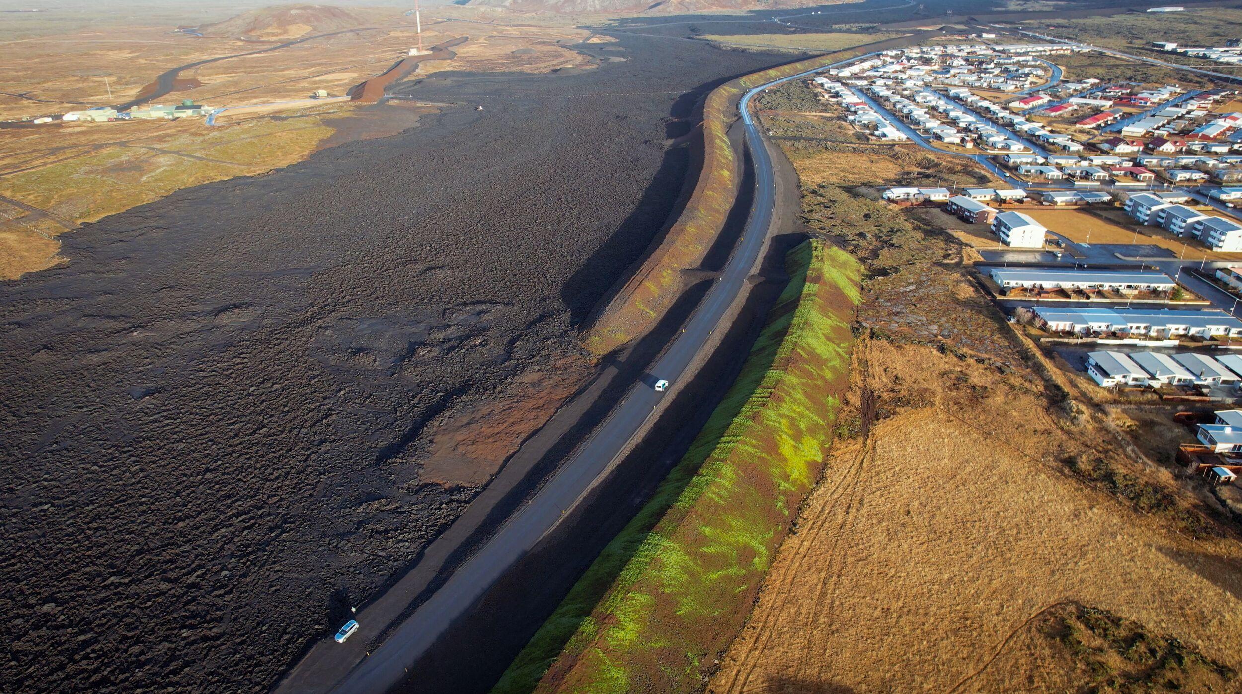
Volcanic Wonders with Grindavik Visit
Once a bustling fishing village, Grindavík now serves as a stark reminder of nature’s relentless power. After a recent volcanic eruption forced the evacuation of its residents, much of the town remains uninhabitable, its landscape forever marked by the destructive forces of the earth.
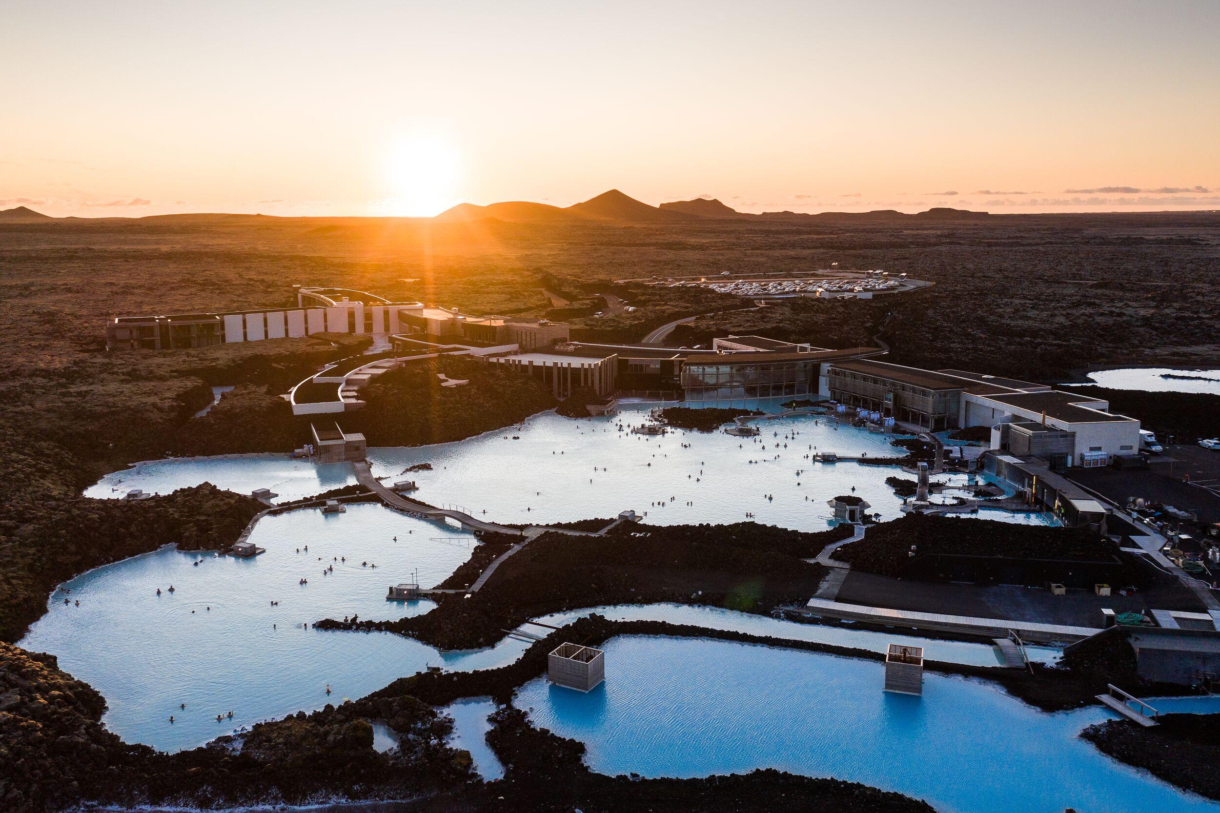
Volcanic Wonders with Grindavik Visit & the Blue Lagoon
Embark on a carbon-neutral journey through Iceland’s stunning volcanic landscapes. Enjoy a refreshing hike across a lava field, formed by recent eruptions, and then unwind with a soothing soak in the healing geothermal waters. This perfect combination of adventure and relaxation offers an unforgettable way to experience the raw power and serene beauty of Iceland’s natural wonders.
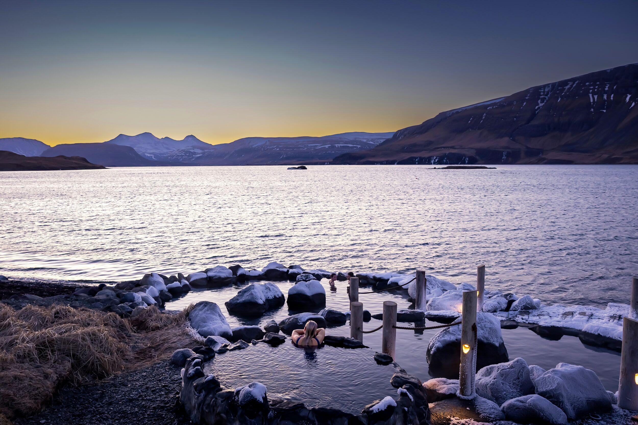
Volcanic Wonders with Grindavik Visit & the Hvammsvík Hot spring
Discover Iceland’s geothermal wonders in the UNESCO-recognized Reykjanes Geopark, a dramatic landscape where continents drift apart. This carbon-neutral journey takes you through vibrant geothermal fields, new lava fields, and the village of Grindavík, before concluding with a serene soak at Hvammsvík Hot Springs.

