Situated within the Torfajökull volcanic system, this mountain is shaped by the divergent boundary between the North American and Eurasian tectonic plates, making it a hotspot for volcanic and geothermal activity. Its unique rock composition and ongoing geothermal processes create a dynamic landscape of vivid colours and remarkable geological features.
- Best time to visit
- Summer
- Coordinates
- 63.981227573054866, -19.145661461035175
- Distance from Reykjavík
- 180km (112mi)
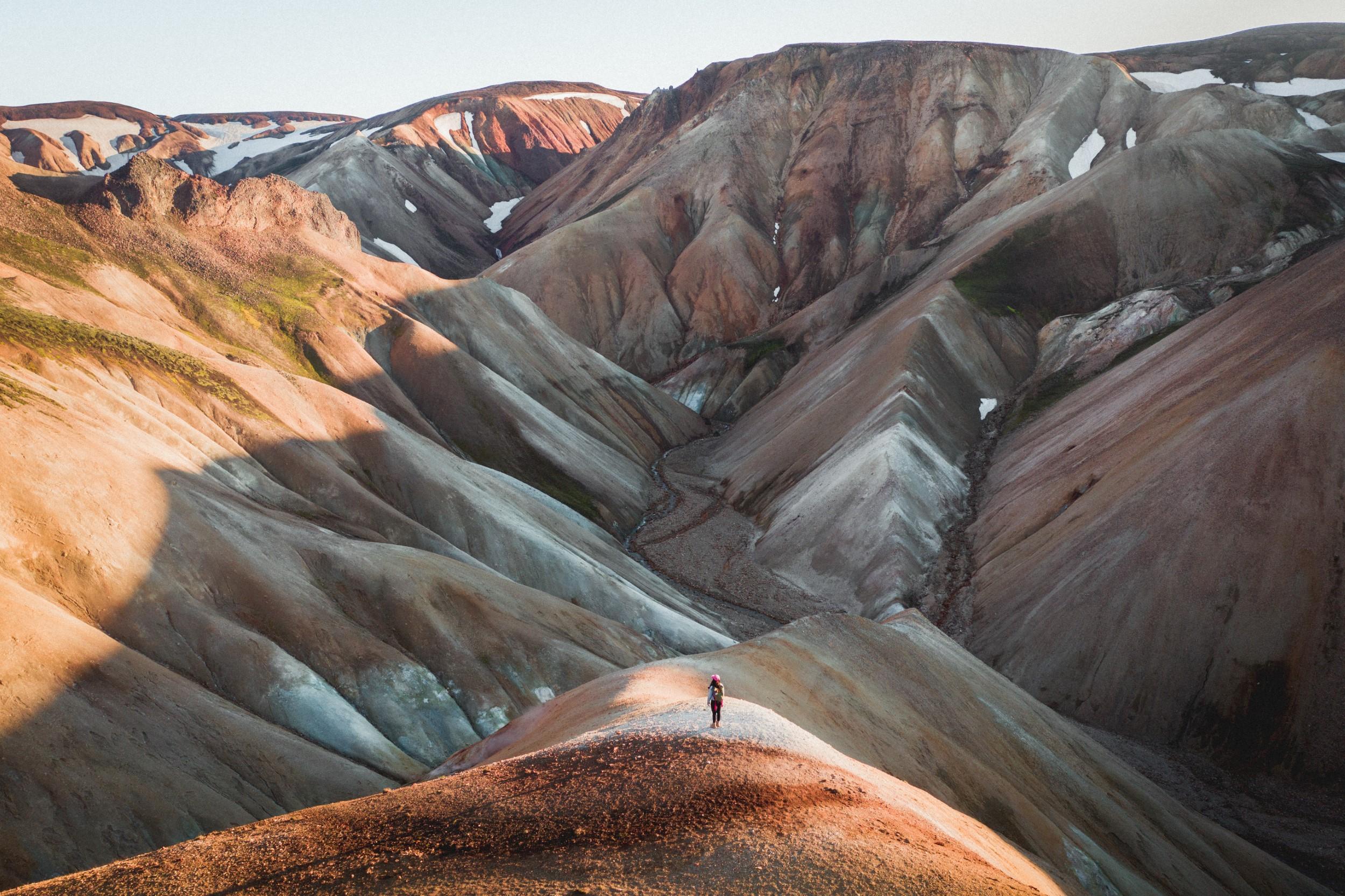
Brennisteinsalda, often referred to as the "Sulphur Wave," is one of Iceland's most vibrant and geologically intriguing mountains. Its name, derived from the Icelandic words for sulphur (brennisteinn) and wave (alda), aptly describes the mountain's colourful appearance, which results from the rich sulphur deposits and geothermal activity in the area. Rising majestically within the Landmannalaugar region, Brennisteinsalda captivates visitors with its striking hues of red, yellow, green, and blue, creating a natural palette that stands in stark contrast to the surrounding rugged landscape.
Importance of the Region
The Landmannalaugar region, encompassing Brennisteinsalda, is of paramount importance both scientifically and environmentally. This area is a hotspot for geological research due to its active geothermal systems and diverse volcanic formations.
The unique interplay of volcanic and geothermal processes provides invaluable insights into Earth's dynamic interior. Ecologically, the region supports a variety of specially adapted flora and fauna, some of which are endemic to Iceland. This biodiversity, thriving in such a harsh and volatile environment, highlights the resilience of life and the importance of conservation efforts to protect these unique ecosystems.
Geographical Location
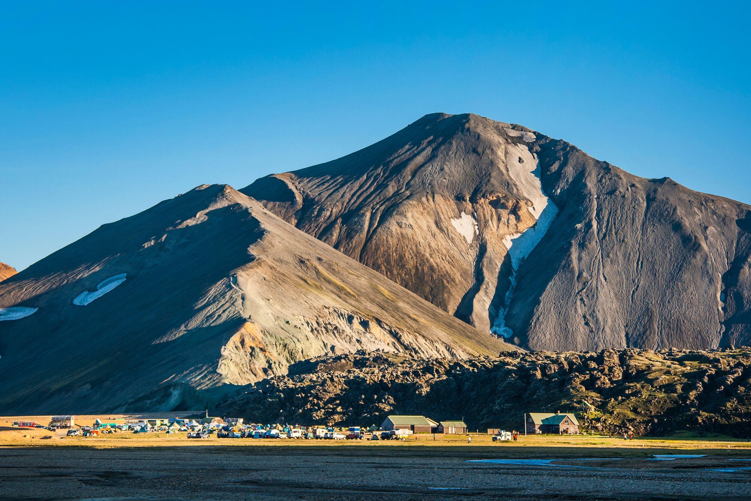
Brennisteinsalda is located within the Fjallabak Nature Reserve in the southern Highlands of Iceland. The mountain is part of the larger Torfajökull volcanic system, known for its extensive rhyolite lava fields and geothermal activity. Situated at approximately 63.98°N latitude and 19.06°W longitude, Brennisteinsalda is easily accessible from the Landmannalaugar base camp, a popular starting point for hikers and outdoor enthusiasts.
The region is characterised by its remote and rugged terrain, offering breathtaking vistas and a sense of isolation that draws adventurers from around the world. The proximity to the Mid-Atlantic Ridge, where the North American and Eurasian tectonic plates diverge, further underscores the geological significance of this remarkable landscape.
Geological Formation and History
Brennisteinsalda is a product of Iceland's intense volcanic activity, situated in the Torfajökull volcanic system. Shaped by the divergent boundary between the North American and Eurasian tectonic plates, the region has experienced numerous eruptions since the Holocene epoch, with the last significant eruption around 1477 AD.
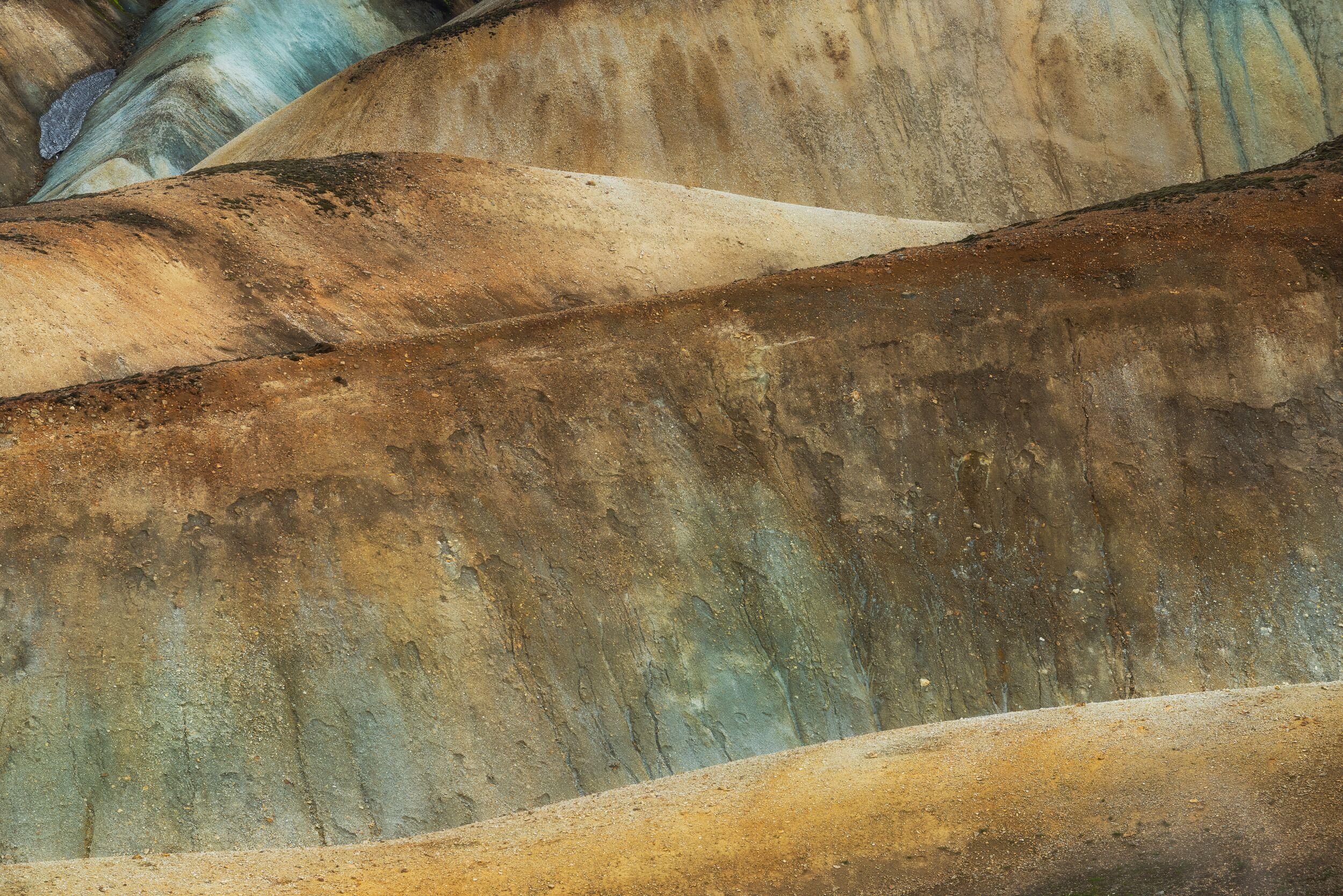
These events produced extensive lava flows, pyroclastic deposits, and rhyolitic domes. The mountain's vibrant colours and unique geological features stem from its diverse rock composition, primarily rhyolite, interspersed with layers of basalt and prominent sulphur deposits from geothermal vents, creating its characteristic yellow and green hues.
The ongoing geothermal activity profoundly impacts Brennisteinsalda's landscape. Fumaroles, emitting sulphurous gases, create striking sulphur crystals and indicate the geothermal processes beneath the mountain. This activity also supports hot springs and mud pots, adding to the region's geothermal complexity.
The thermal emissions and heat continuously alter the mineral composition of the rocks, leading to vivid colouration and new mineral deposits. This dynamic environment shapes the physical landscape, providing insights into the interactions between volcanic and geothermal processes while supporting unique ecosystems through geothermal heat.
Historical Significance and Hiking Trails
The Landmannalaugar region, including Brennisteinsalda, holds a significant place in Icelandic history and culture. The area's geothermal hot springs have been utilised by locals for centuries, offering a warm refuge in an otherwise cold and remote environment.
Early Icelandic settlers likely recognised the unique geothermal features and used the hot springs for bathing and washing, appreciating the natural warmth provided by the Earth's geothermal energy. The vibrant colours and striking landscapes of Brennisteinsalda have also inspired Icelandic folklore and sagas, embedding the mountain within the cultural fabric of the nation.
Exploration and Hiking Trails
Exploration of Brennisteinsalda and the surrounding Landmannalaugar region began in earnest during the 19th century, with scientists and adventurers drawn to the area's unique geological and geothermal features. Notable explorers and geologists, such as Þorvaldur Thoroddsen, documented the region's volcanic activity and geological formations, contributing to the broader understanding of Iceland's dynamic landscape.
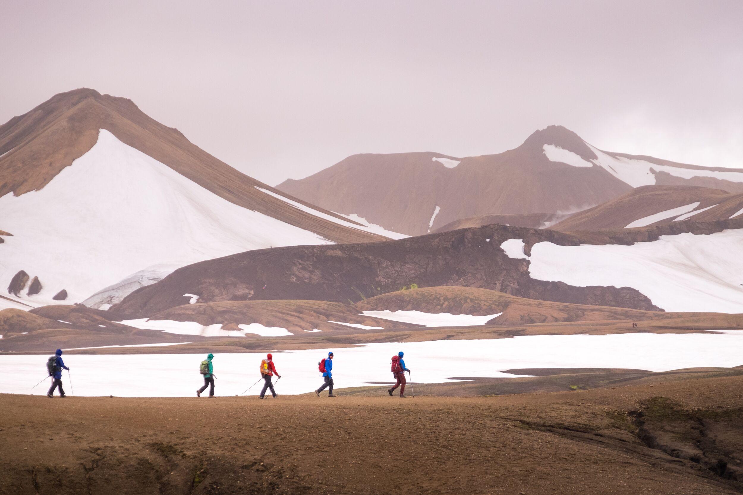
Today, Brennisteinsalda is a popular destination for hikers and outdoor enthusiasts. The mountain is part of several well-known hiking trails, including the Laugavegur trail, which is considered one of the most scenic hikes in the world.
This trail, stretching from Landmannalaugar to Þórsmörk, offers hikers the opportunity to traverse a diverse landscape of rhyolite mountains, hot springs, and vast lava fields. The hike to Brennisteinsalda itself is relatively accessible, providing breathtaking views of the surrounding region and a close-up experience of the mountain's colourful slopes and geothermal activity.
Tourism and Its Impact
The rise of tourism in Iceland has brought significant attention to Brennisteinsalda and Landmannalaugar, transforming the area into a major attraction for international visitors. The unique geological features, combined with the stunning natural beauty, draw thousands of tourists each year. While tourism provides economic benefits and raises awareness about the importance of preserving such natural wonders, it also poses challenges for conservation.
The increased foot traffic on hiking trails can lead to soil erosion and degradation of delicate ecosystems. The presence of visitors can also impact the geothermal features, as careless behaviour might damage fumaroles and hot springs.
To mitigate these effects, measures such as designated walking paths, informative signage, and strict guidelines for visitor behaviour have been implemented. Conservation efforts focus on balancing the influx of tourists with the need to preserve the natural environment for future generations.