- Best time to visit
- Summer
- Coordinates
- 63.63321, -19.60782
- Distance from Reykjavík
- 150km (93mi)
What to know about Eyjafjallajökull
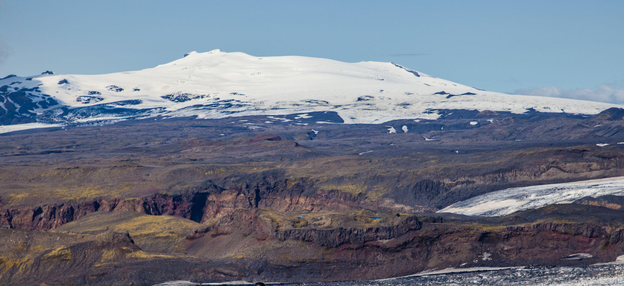
Eyjafjallajökull, with its cone-like shape, is a towering stratovolcano, standing at 1,651 meters (5,417 feet). It’s probably Iceland’s is best-known, which caused international travel chaos back in 2010.
Ice and fire are closely linked in Iceland. In fact, like many other volcanoes in Iceland, Eyjafjallajökull takes the name of the ice cap itself. While this name is well-known around the world, few people know what it means—or how to succeed with Eyjafjallajökull’s pronunciation. It’s simple, really. The name breaks down into three parts: eyja-fjalla-jökull, meaning something like island-mountain-glacier.
Come and visit for yourself, to explore the elemental forces that make Iceland so distinct.
A brief history of the 2010 Eyjafjallajökull eruption
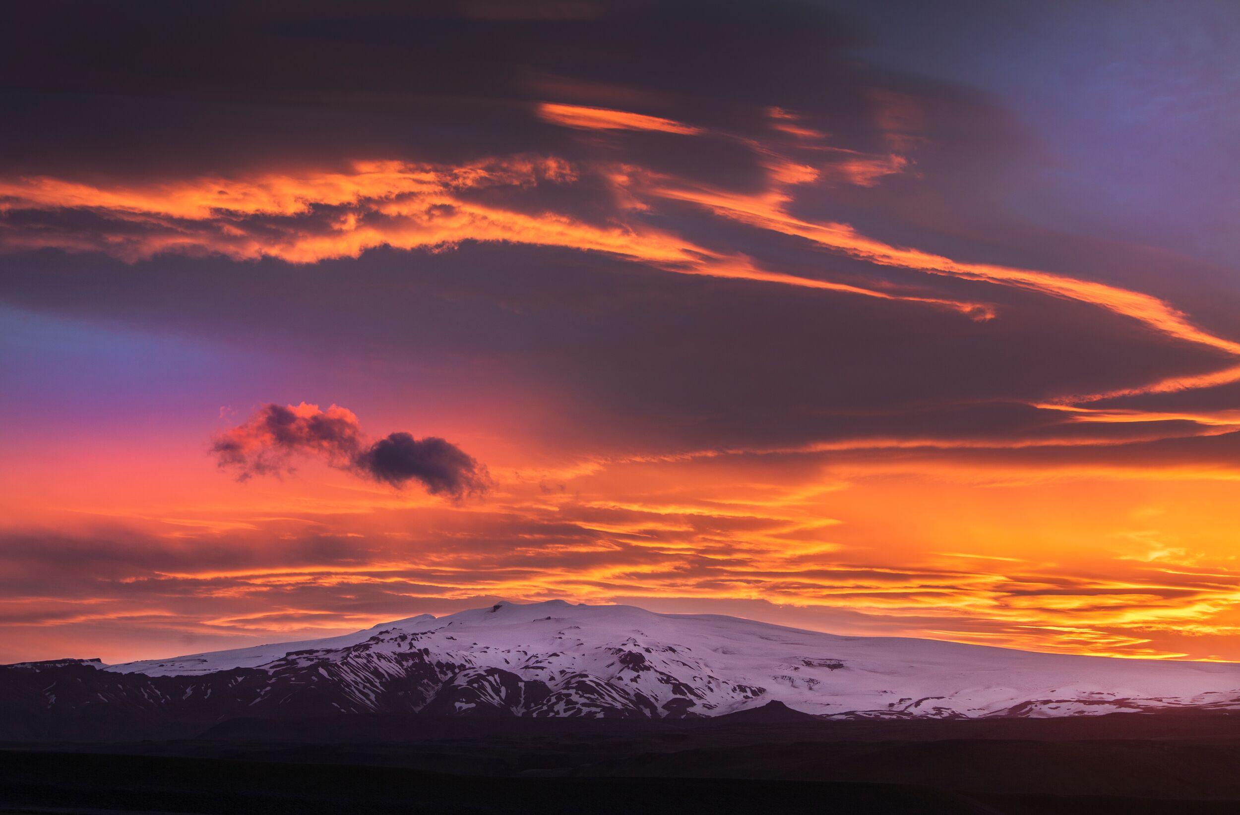
It’s fair to say that Eyjafjallajökull is Iceland’s best-known volcano, thanks to its 2010 eruption, which fired millions of tonnes of ash and gases into the atmosphere—and propelled this volcano to international stardom.
The first documented eruption of this volcano is traced to the ninth century. Since Iceland was settled in 874, Eyjafjallajökull has awakened five distinct times: in 920, 1612, and between 1821 to 1823, leaving lasting imprints on the terrain.
The fascinating thing is that in most cases, the neighbouring volcano, Katla, erupted soon afterwards. We’re waiting to see whether that will happen this time too.
Luckily, the 2010 eruption didn’t have significant impacts on human life. A smaller eruption occurred on March 20th at Fimmvörðuháls, between Eyjafjallajökull and Mýrdalsjökull glaciers. It birthed two craters, Magni and Móði, on a popular hiking trail. By April 12th, it released 0.026 cubic kilometres of lava and tephra, drawing tourists and experts. A month later, Eyjafjallajökull erupted for real.
On April 14, the major eruption began, lasting 71 days. The eruption melted its 250-meter ice cap, producing "jökulhlaup" or glacial floods. Its ash plume, rising 9 kilometres, disrupted European air travel, leading to 100,000 flight cancellations and stranding 2 million people. This event triggered global reassessment of volcanic risks in aviation.
This volcanic changed the landscape and local climate. Farms faced ash contamination, communities evacuated, and ashfall posed health risks. Air travel disruptions impacted Iceland's economy, especially tourism. Yet, communities rallied: through resilience, mutual support, and determination, affected communities gradually regained their footing. This eruption served as a reminder of the importance of readiness for future volcanic events and a shift towards proactive risk management.
How to visit Eyjafjallajökull
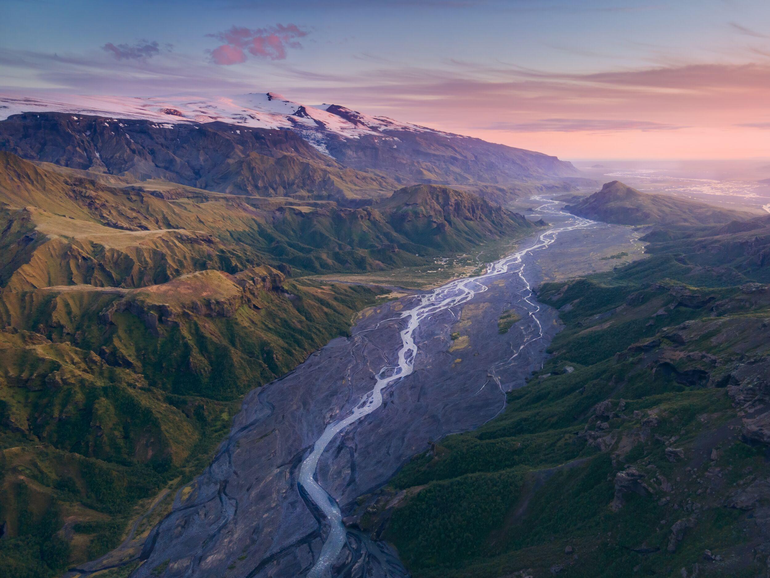
The magnificent volcano, Eyjafjallajökull, is located at the heart of Iceland’s south coast. Its icy peak stands to the north of the famous waterfall, Seljalandsfoss, and is prominently visible (weather permitting) from the road between Skógafoss and Seljalandsfoss.
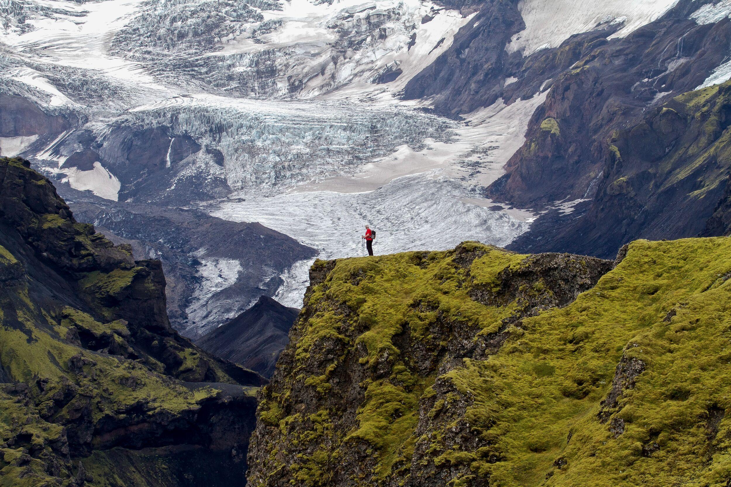
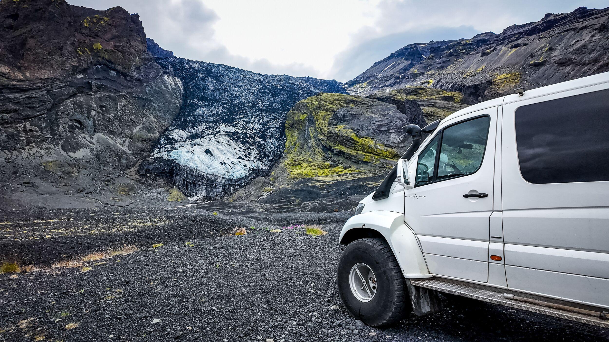
For a thrilling experience of Eyjafjallajökull, consider trekking the Fimmvörðuháls trail. This scenic hike offers close-up views of three glaciers: Eyjafjallajökull and Mýrdalsjökull, and Tindfjallajökull glacier. The 25-kilometre (15.5-mile) path takes you high up into the elements, and you'll literally traverse in between Eyjafjallajökull and Mýrdalsjökull.
As you journey, witness the dramatic aftermath of the volcano's might, including expansive lava fields and craters. The trail doesn't ascend the glacier itself, but it passes by Magni and Modi, two craters birthed during the Fimmvörðuháls eruption, a precursor to Eyjafjallajökull's main eruption. The hike, connecting Skógar to Thorsmörk, can be undertaken from either direction, offering diverse perspectives of the captivating landscape.
What to see and do around Eyjafjallajökull
Eyjafjallajökull and its environs are brimming with adventurous possibilities. From exhilarating treks to stunning waterfalls, there's an experience for everyone.
While the 25-kilometre Fimmvörðuháls hike might be daunting for some, plenty of shorter trails allow for exploration on foot. One option is a gentle walk from the parking area to the vantage point overlooking Sólheimajökull, a section of the Mýrdalsjökull glacier. Here, you can savor distant views of Eyjafjallajökull. However, it's crucial to note: approaching the glacier unguided is dangerous. To safely experience this glacier tongue up-close, consider a professionally led glacier hiking tour.
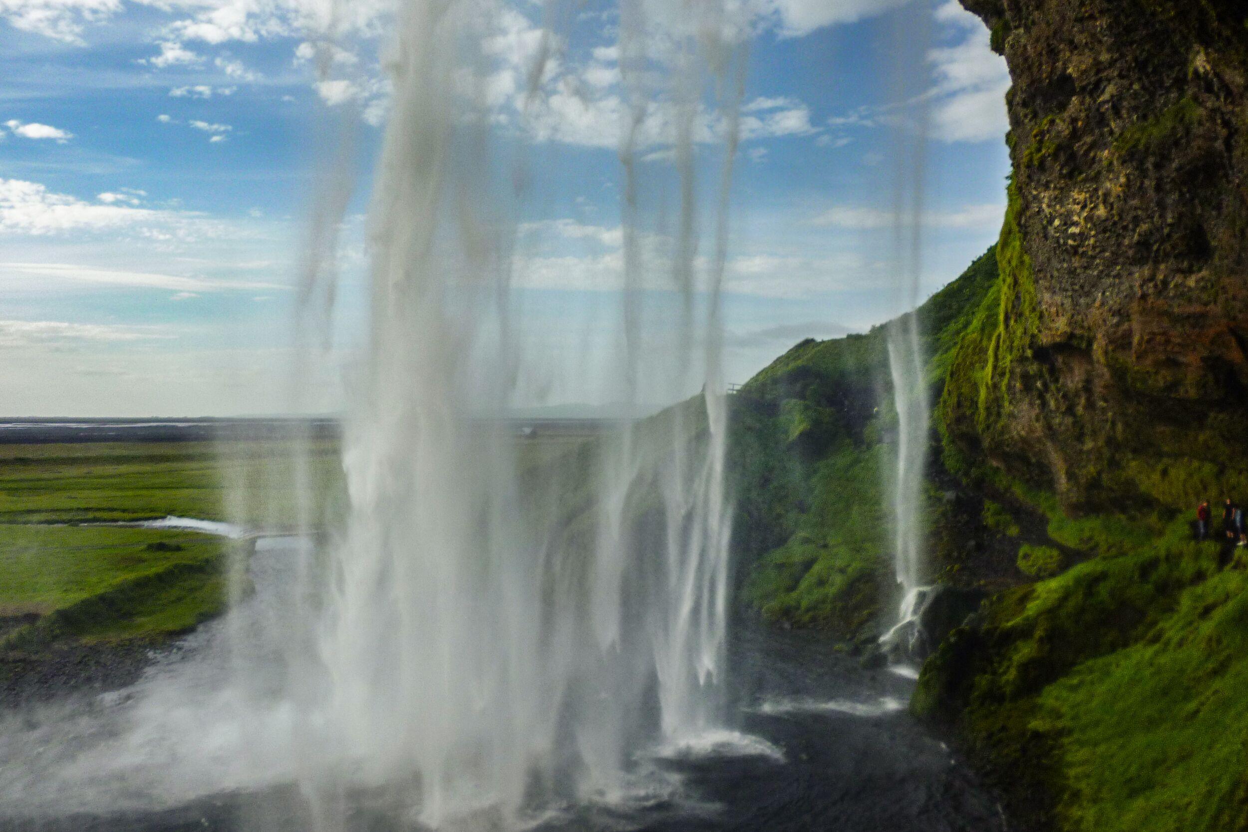
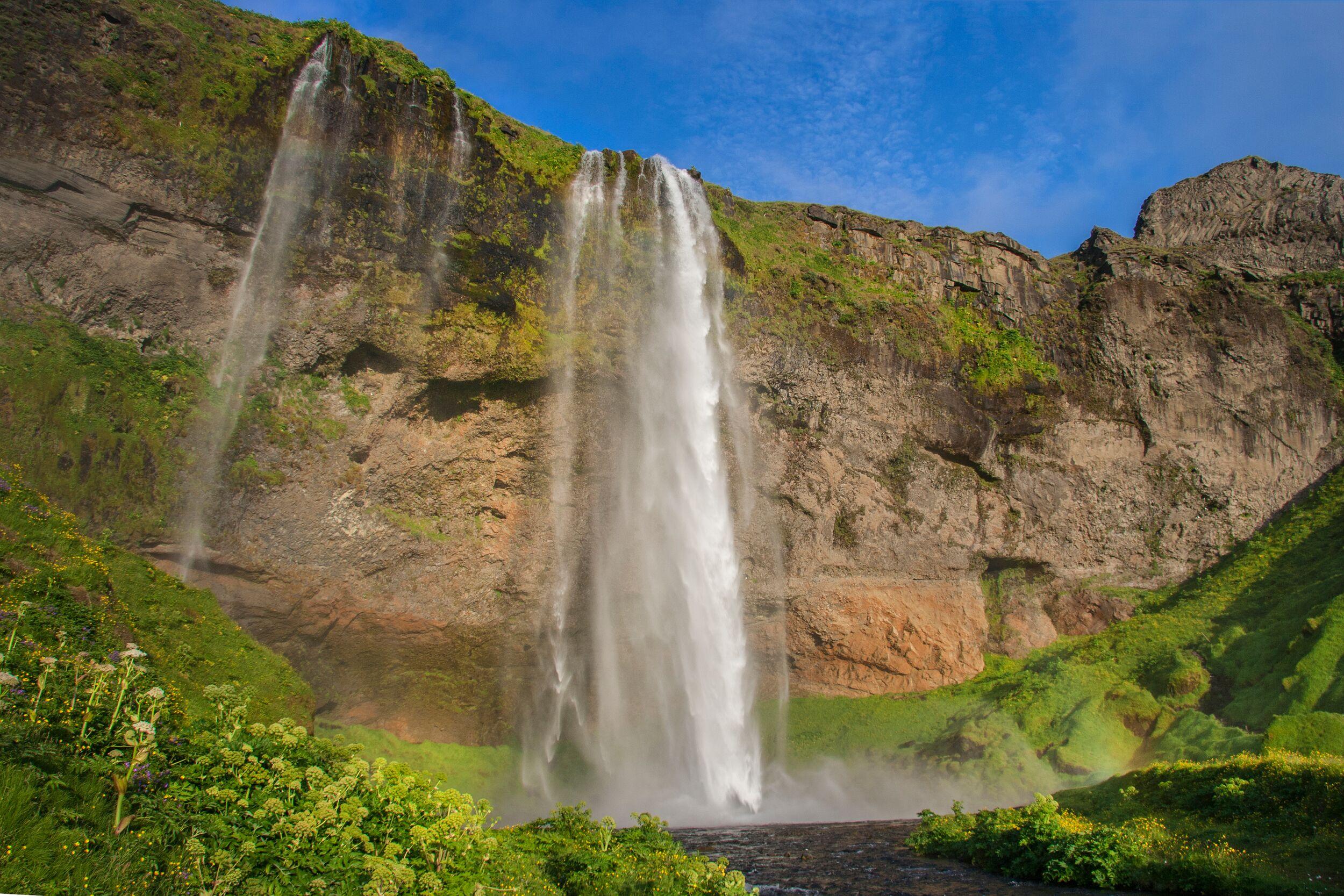
Another must-visit is Seljalandsfoss, a graceful waterfall fed by the waters of Eyjafjallajökull, cascading down the Seljalandsá river. For an enchanting experience, venture behind the waterfall's curtain.
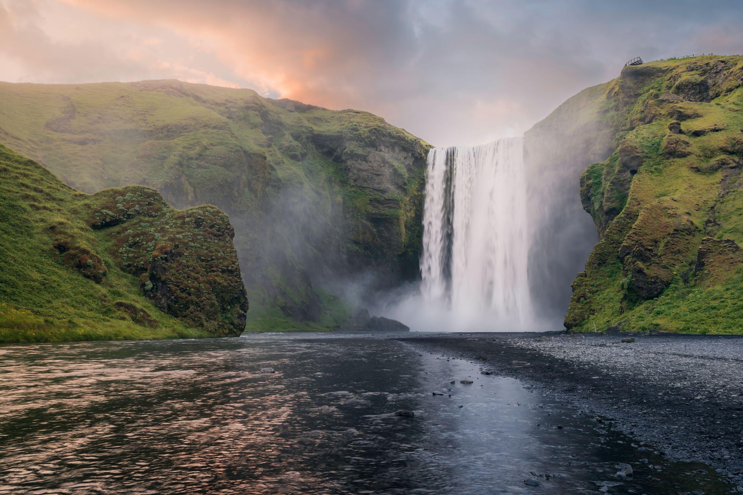
The area's other standout waterfall is Skógafoss, which marks the beginning of the Fimmvörðuháls trail. If you're not keen on traversing the entire trail, opt for a gentler walk along the river above Skógafoss, continuing until you reach a vast canyon. From there, retrace your steps back down to the waterfall. This hike spans approximately 8-9 km (about 5-5.6 miles) round trip and promises a series of captivating waterfalls and breathtaking vistas.
Additionally, a unique ice cave accessible throughout the year lies nearby. Named after Eyjafjallajökull's neighboring volcano, Katla, this cave is remarkable for the volcanic ash embedded in its ice.
Expand your itinerary by adding nearby attractions. Explore the iconic Reynisfjara black-sand beach near the quaint fishing village of Vík. These sights together make an unforgettable Iceland South Coast trip itinerary!
Frequently asked questions
Eyjafjallajökull’s white bulk is easily visible from the Ring Road when you drive from Seljalandsfoss to Skógafoss along the South Coast. In Good weather, however, you can see it from hundreds of kilometres away.
If you want to get closer, your best options are to visit from Skógafoss or Þórsmörk. A trail known as Fimmvörðuháls connects these two places and ventures over the pass next to Eyjafjallajökull. You’ll see the enduring effects of the 2010 eruption, including volcanic craters and lava fields.
The most convenient place to see Eyjafjallajökull is from Route 1, the ring road that loops around the whole of Iceland. After about 2 hours drive from Reykjavík, you’ll find a visitor point with information about the volcano. And there you’ll see the volcano, right from the road.
To witness the glacier and volcano in more detail, visit on foot from Skógafoss or Þórsmörk. This way, you’ll get to see this rugged river of ice and its devastating impacts up close.
Eyjafjallajökull can be seen from Route 1, the road often known as Iceland’s Ring Road. There is a visitor information point on the south side of the road about 2 hours from Reykjavík. The glacier is easily seen from here.
If you’re coming from Reykjavík, in about 90 minutes you will reach the village of Hvolsvöllur. After the village, continue along Route 1 for another half an hour. Once you have passed lake Holtsós, you will soon reach the Eyjafjallajökull info point.
Eyjafjallajökull is not really close to any major city. Reykjavík, the closest, is a 2-hour drive by car.
The nearest settlements are Hvolsvöllur or Vík. Holsvöllur has a population of about 1,000, while Vík is slightly smaller.
Eyjafjallajökull is one of the most beautiful glaciers in Iceland, as well as being almost certainly the country’s most famous volcano. It’s a combination of the two things for which the Land of Ice and Fire is known.
It also makes a brilliant day out.
Whether you’re hiking the Fimmvörðuháls trail from Skógafoss or Þórsmörk or visiting the surrounding area on a glacier experience, your encounter with Eyjafjallajökull will be unforgettable.
While it sure looks complicated, the name Eyjafjallajökull is actually pretty simple.
Let’s break it down. There are three main parts to the word Eyjafjallajökull. Eyja means islands. Fjalla means mountain, like in the English word “fell”. Finally, jökull means glacier. If you put them back together you have something like “island mountain glacier”.
No one died in the 2010 eruption of Eyjafjallajökull. There were reports of some very minor health problems—such as irritated eyes and throats—but nothing that caused significant harm. Everyone who was likely to have been affected by the eruption was evacuated before it happened.
That said, the volcano did have a big impact on international travel. For example, air travel in Europe was disrupted for many days, affecting nearly 2 million people.
One of the main reasons that Eyjafjallajökull didn’t cause more harm than it did to local people was that the volcano had been closely monitored and the eruption had been predicted.
As Iceland is such a volcanically active country, it is always monitored for continuing volcanic activity. According to some estimates, a volcanic eruption happens in Iceland on average every 5 years—so we need to be prepared!
The last time that Eyjafjallajökull erupted was in 2010. It was the largest eruption of this volcano ever recorded.
It’s thought that eruptions of Eyjafjallajökull tend to cause subsequent eruptions of Katla, the much larger volcano next door. So far, there haven’t been any further eruptions, but it may happen soon.
As many as 800 people were evacuated from areas at risk of being affected by Eyjafjallajökull. These included residents of nearby villages, Fljótshlíð, Eyjafjöll, and Landeyjar.
Related tours
South Coast Explorer - Waterfalls, Black Beaches & Glacier Views
Buckle up for an epic South Coast adventure where waterfalls thunder, glacier rivers splash beneath your tires, and black sand beaches stretch to the horizon. This isn’t your average sightseeing tour—it’s a rugged, small-group experience that takes you deeper into Iceland’s dramatic landscapes, all from the comfort of a luxury Super Jeep.
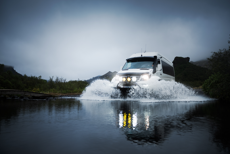
Thórsmörk - Valley of Thor Super Jeep Tour
Join an extraordinary adventure through Iceland's rugged landscapes with our exclusive Þórsmörk Super Jeep Tour. Explore the Valley of Thor in style, led by expert guides who know every inch of this stunning terrain.
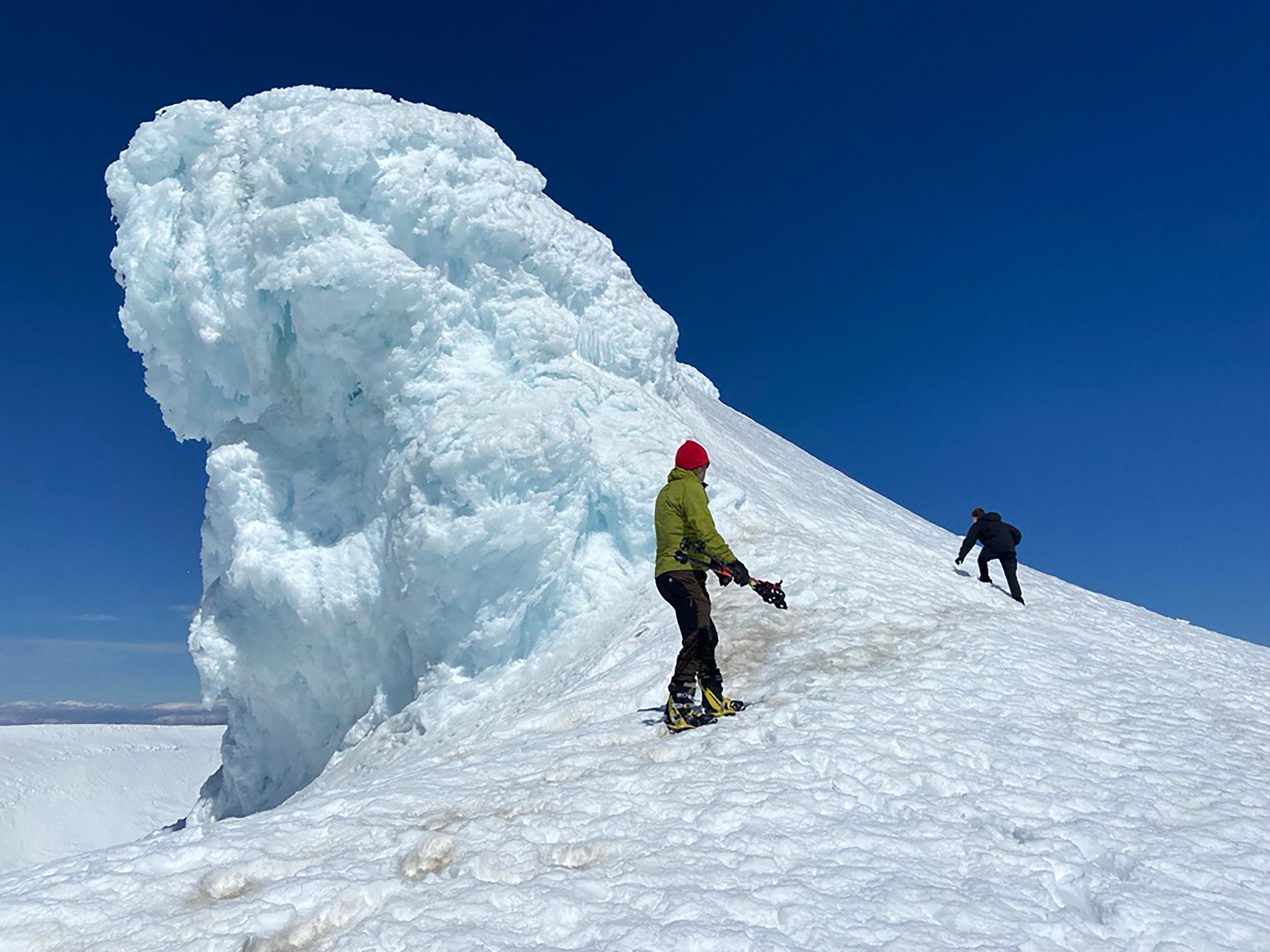
Eyjafjallajökull Summit Hike
Hike to the summit of Eyjafjallajökull Volcano—a thrilling day hike for experienced hikers seeking a manageable challenge. Traverse rugged terrain and enjoy breathtaking views of the Highlands, Mýrdalsjökull, and Vestmannaeyjar Islands.